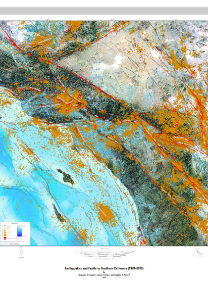
Earthquakes and faults in southern California (1970--2010)
USGS Scientific Investigations Map: 3222
A print version of this publication is not available from the USGS
Abstract:
The map depicts both active and inactive faults and earthquakes magnitude 1.5 to 7.3 in southern California (1970–2010). The bathymetry was generated from digital files from the California Department of Fish And Game, Marine Region, Coastal Bathymetry Project. Elevation data are from the U.S. Geological Survey National Elevation Database. Landsat satellite image is from fourteen Landsat 5 Thematic Mapper scenes collected between 2009 and 2010. Fault data are reproduced with permission from 2006 California Geological Survey and U.S. Geological Survey data. The earthquake data are from the U.S. Geological Survey National Earthquake Information Center.
--
Zenguins!
Vei8-Volcanoes of the World Webcams
Roxxfoxx~~Adventures in Geology
Penguin News Today
Penguinology: The Science of Penguins
Gentoo Penguins of Gars O'Higgins Station, Antarctica
Canis lupus 101
Dances with Werewolves
Through Golden Eyes

__._,_.___
No comments:
Post a Comment