Icelandic Eruption Spews Record-Breaking Amounts of Lava, With No Signs of Slowing
A remote eruption in Iceland continues to send forth copious amounts of lava, monitored closely by the scientific community.
Devin Powell
for National Geographic
Published October 13, 2014
A tremendous gush of lava in Iceland that began six weeks ago shows no signs of slowing. The eruption, on a plain of old lava called Holuhraun in the Bárðarbunga volcanic system, has spewed out enough molten rock so far to fill 740 Empire State buildings and has buried, on average, an area the size of an NFL football field every 5.5 minutes.
At this rate, the lava flow will soon be larger than any seen for more than two centuries in the volcanically active island nation. And there's no telling when it will stop—months, maybe, or years.
"It's amazing that it has gone on at this rate for so long," says volcanologist John Stevenson of the University of Edinburgh. (See "Icelandic Volcano Rumbles Raise Eruption Fears.")
No one lives near the growing lava flow. But continuing earthquakes associated with the eruption suggest that a separate eruption is possible. If new lava emerges under the nearby ice cap, the meeting of fire and ice could unleash massive floods and belch out a cloud of steam-driven ash similar to the plume that disrupted air travel during the 2010 eruption of Eyjafjallajökull. (See "Q&A: Why Iceland's Volcanoes Have Vexed Humans for Centuries.")
Despite its remoteness, the Holuhraun eruption is one of the best monitored in history, thanks to new instruments deployed by the European Commission-funded FUTUREVOLC project and other international teams.
Scientists hope lessons learned at Holuhraun will also help them understand the formation of ocean floors, which, like Iceland's eruptions, takes place at geological seams where tectonic plates tear apart from each other.
"We have a lot, a lot of data, so much data that we can really see how the eruption is evolving," says FUTUREVOLC member Stéphanie Dumont, a geophysicist at the University of Iceland's Institute of Earth Sciences. A network of seismometers, for instance, helped scientists track the rock-splitting movements of the subterranean magma now feeding the eruption.
At first a shallow underground chamber was thought to be the source of the magma beneath this Bárðarbunga eruption. But the longer the lava continues to flow, the more likely a deeper reservoir is involved, says volcanologist Agust Gudmundsson of Royal Holloway, University of London. "We do not know of any volcano in the world where you can tap a shallow chamber and it keeps open this long."
There's no telling when the spigot to the depths will turn off, so there may be a lot more lava to come and a lot more sulfur dioxide, a toxic gas released by the eruption that can drift long distances. (See "Iceland Volcano Spews Giant Ash Clouds.")
With no end in sight—eruptions that produce large amounts of lava often last months or even years—the eruption may soon have new mythical name worthy of its legendary proportions. Inspired by strands in the flow that are whimsically said to resemble a witch's hair, University of Iceland volcanologist Thor Thordarson has suggested calling it Nornahraun, meaning "witch's lava."
Video available at source below:
~~~~~~~~~~~~~~~~~~~~~~~~~~~~~~~~~~~~~~~~~~~~~~~~~~~~~~~~~~~~~~~~~~~~~~~~~~~
Victoria's forgotten volcano region
- Monday 13 October 2014 8:43AM
- Ann Jones
")
Move over Indonesia and Sicily, one of the world's great volcanic regions is in central-western Victoria. Ann Jones meets Melbourne seismologist Gary Gibson, whose pioneering research into mid-continental volcanoes is challenging orthodoxies.
'We've got one of the most magnificent volcanic areas in the world.'
'I'm biased of course,' says University of Melbourne seismologist Gary Gibson, who lives in the Victoria's central goldfields.
Although seismologists generally deal with earthquakes, Gibson has a passion for volcanoes, especially the ones that are right next door to his place.
We're looking out across a cluster of hills of different sizes; they're all rounded, covered in pasture and have fences transecting them.
Gold rush-era miners figured out that the gold was below the old lava flows and mined it relentlessly, leaving the area we are standing in scattered with mullock heaps.
To the untrained eye it's idyllic, but not recognisable as a unique collection of every type of volcano possible in the middle of a continental plate.
South-west Victoria, insists Gibson, is a very special volcanic region.
'[It's] a very, very young sequence of volcanoes. Some of them probably date back to about four or five million years, and the youngest of them are post-Aboriginal, almost certainly.'
Mount Gambier, over the border in South Australia, last erupted about 4,000 or 5,000 years ago.
'If you looked at the total number of volcanoes, there are a few hundred in the last 100,000 years than average, so it's not an activity that has finished.'
A basic understanding of volcanoes indicates that they mostly occur on tectonic plate boundaries, where there is a logical gap in the surface of the earth and a reason for magma to be forced up and out into the atmosphere.
So why is this cluster of volcanoes happening right here near Smeaton, smack bang in the middle of the Indo-Australian Plate?
'Most of the molten rock comes from the Earth's mantle,' says Gibson. 'The Earth's mantle, in fact, is solid for thousands of kilometres down, but for some reason or other, locally you get melting. It can be because of heating due to radioactivity in rocks, or it can be because of friction from tectonic movement within the plates.'
'But the local area is, of course, much smaller than you get at the plate boundaries. In general the continental volcanoes are small ones.'
Gibson tells me that for intra-continental volcanoes, there are three main types, and that we can see an example of each one here in the Western Uplands volcanic sub-province of Victoria.
'[The first type are] the ones that give out lava that flows across the surface, and most of the surface here has been covered with lava,' Gibson says, gesturing across the paddocks with one arm.
'We've got volcanoes that give out ash, and you develop ash cones, and you've got others that are rather unusual, they don't happen many places around the world: if you've got the lava coming up through sediments, sedimentary rocks and limestone, you get a thing called a maar.'
'A maar is a circular volcano where, when the lava reaches the surface, it is bubbling away and it is throwing out a rock called tuff; it's a mixture of volcanic material, ash from the volcano and country rock that's been picked up on the way.'
With apologies to Keith Urban fans, country rock is a geology term that refers to naturally occurring rock from a particular area. In this case, it is dragged up by volcanic forces.
'[The volcano] throws it around the edges and you end up with the tuff ring, that's a ring of tuff,' says Gibson. 'In this case it's about 40 metres high for a few hundred metres around in a circle.'
'Victoria has a remarkable number of tuff rings compared to most places.'
Gibson loves this place. Seeing these distinct types of volcanoes from one vantage point is a rarity.
It is also beautiful, especially in spring. The tuff rings and other volcanic by-products mean that this area of Victoria boasts incredibly fertile farmland with rich dark soils that yields potatoes, fat lambs and cereal crops.
There has been another important flow-on effect from volcanic activity in the area: gold.
In the millions of years before the volcanoes, gold in original bedrock was gradually uncovered as the surface weathered and eroded, and was carried down streams. Being heavy, it fell to the bottom and accumulated in the bottom of valleys.
'The volcanoes have come along and put on a protective coating, filled the valley [with lava] and covered the old streams, and they were known as "deep leads"—The richest alluvial gold you'd find almost anywhere in Central Victoria,' says Gibson.
Related: Entering the volcano
Gold rush-era miners figured out that the gold was below the old lava flows and mined it relentlessly, leaving the area we are standing in scattered with mullock heaps.
They're often a lighter colour than the topsoil—ancient earth from under the old lava flows which has been pulled up, sieved crudely for the gold then left behind in a malformed lump.
Around the edges of the mullock heaps, lambs call out for their mothers and corellas scream quaintly at their cousins and significant others.
It's hard to imagine this as the centre of an incredible volcanic discovery, but it is.
Gibson is a seismologist, and volcanoes don't necessarily fall within his traditional job description. Of course, there is a relationship between them and earthquakes.
When there is a volcanic eruption, the movement of magma through the earth's surface creates rumbles and shakes, and there may even be continuous movement. Volcanoes cause earthquakes.
What about the other way around, though? Earthquakes affecting volcanoes?
Over the last 40 years the seismograph network has improved dramatically in Victoria, a project that Gibson has been heavily involved in.
'There is a little area of about 50 square kilometres, more or less centred on where we are that I've been watching. Over the last 50 years, we've recorded 727 earthquakes, most of them not felt—they were too deep, but the instruments were sensitive enough to record them,' says Gibson.
The quakes are centred around the Muckleford fault, which lies west of Castlemaine.
'In 1991 we had 300 events in one sequence. In 2012 we had a spate of activity: we had 120 of them on Muckleford fault.
'They're the earthquakes that are happening now, geologically now: the last 40 years.'
Gibson and his colleague, Associate Professor Bernie Joyce, have worked to place all the quakes on a map, where they appear as small clusters.
'If you look at the map of volcanoes, they're a little bit like that, but there's a bit of a pattern to them. So we thought, "Hello, how do they relate to each other?"'
'So I've produced a map where I've plotted the earthquakes, and I've plotted the volcanoes and what's happening? Are the earthquakes occurring where the volcanoes occur? No! Not even slightly!'
-

Listen to this episode of Off Track to find out more.
The current theory as to why earthquakes do not occur in the same places as these mid-continental volcanoes has to do with temperature.
Around the volcanoes, where magma once flowed up through all the layers of minerals, the rocks are at a higher temperature. Those higher temperatures make the rock softer, which brings plasticity, meaning the rock absorbs stress by warping rather than cracking.
'It was a total surprise, I must admit, because I was expecting there to be a positive correlation between them, but it's quite different,' says Gibson.
The scientists are working towards the publication of their results.
Gibson says he'll continue to observe the earth's movements because he's really a failed retiree who can't stay away from his seismometer readings.
He'll keep an eye on the local volcanoes as well, just in case.
'The chances of another one happening here, if they're happening every few thousand years: you work it out.'
http://www.abc.net.au/radionational/programs/offtrack/victorias-forgotten-volcano-region/5801520~~~~~~~~~~~~~~~~~~~~~~~~~~~~~~~~~~~~~~~~~~~~~~~~~~~~~~~~~~~~~~~~~~~
Poás volcano
Tourist access to Poás Volcano closed after eruptions Monday
L. Arias 8 hours ago Comment
 Email
Email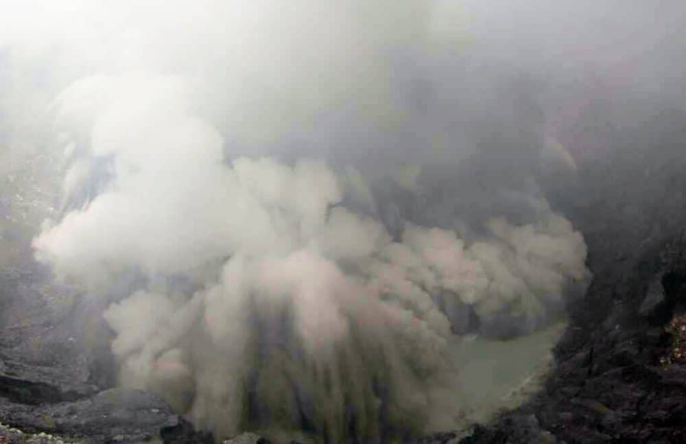
OVSICORI's crater webcams recorded the explosions at around 9 a.m. on Monday.
(Courtesy of OVSICORI)
Tourist access to the Poás Volcano National Park in Alajuela was closed Monday morning as a preliminary measure after two explosions were recorded in the volcano's crater.
"Phreatic eruption noted today at 8:58 a.m. The explosion expelled materials that reached the visitors' area," said the National Seismological and Volcanological Observatory (OVSICORI) on their Facebook profile.
National Emergency Commission spokeswoman Rebeca Madrigal confirmed that the organization began emergency protocols and evacuated visitors and park staff as a preventive measure. Access will remain closed for various hours while OVSICORI experts conduct an inspection in the crater, to further evaluate the situation.
"None of the people at the park were harmed and the evacuation was strictly a standard protocol," Madrigal stressed.
OVSICORI will issue an updated report on the popular tourist destinations in coming hours, Madrigal added.
Video of eruption available at:
http://www.ticotimes.net/2014/10/13/tourist-access-to-poas-volcano-closed-after-eruptions-monday
~~~~~~~~~~~~~~~~~~~~~~~~~~~~~~~~~~~~~~~~~~~~~~~~~~~~~~~~~~~~~~~~~~~~~~~~~~~
Kilauea Volcano's Ashen Footprints May Point to Explosive Future

 |
 Footprints preserved in Kilauea volcano ash deposits. Footprints preserved in Kilauea volcano ash deposits.Credit: Don Swanson |
Thousands of human footprints cast in ash at Hawaii's Kilauea volcano are the final steps of people killed in a 1790 phreatic eruption — the same kind of unpredictable blast that caught hikers at Japan's Mount Ontake volcano in late September.
The footprints are evidence that the goddess Pele's reputation for power and ferocity were well-earned in the past, even though Kilauea is a tourist's volcano today. From about 1500 to 1800, Kilauea hurled mighty ash plumes into the jet stream and heaved huge rocks out of its deep caldera, the crater at the volcano's summit. And geologist Don Swanson thinks another round of violent eruptions will happen again.
"Too often, geologists and the general public view Kilauea as safe. It's just a stage that you come to and view a performance of great beauty," said Swanson, a geologist and former director of the U.S. Geological Survey's Hawaiian Volcano Observatory. "I hope that people realize Kilauea is not that way at all. Kilauea is an explosive volcano, and when it gets into an explosive period it can be life-threatening." [Explosive Images: Hawaii's Kilauea Erupts for 30 Years]
Guided by legends
Through decades of detective work, both geologic and historical, Swanson and his collaborators have reconstructed the grim story of the 1790 eruption, which killed at least 80 people. Their latest report was published Oct. 6 in the Geological Society of America Bulletin.
Kilauea erupted in November 1790, according to written records by a castaway and by missionaries who recorded eyewitness accounts from Native Hawaiians. The spectacular ash plume was visible from the island's north coast, and likely reached 30,000 feet (9,150 meters) into the air.
At the time, the doomed army of Keoua, a cousin and rival of Hawaii's Kamehameha the Great, was crossing the Ka'u Desert below Kilauea's summit caldera. A few hours after this first explosion, the volcano pelted the army with wet, muddy ash and pebbly clumps called lapilli. No one knows whose footprints were preserved in the ash. But based on their average length, Swanson thinks women and children were walking through the ash. More than half of the footprints head back in the direction of the eruption, he said.
Three separate groups of warriors, women and children were caught on Kilauea that day. Just after the ash fall, one of three groups was killed by searing heat from a pyroclastic density current — a surge of ash and steam tumbling down the slope with the force of hurricane winds. Some of the dead were reportedly touching noses with loved ones in a final embrace.

 Traces of a deadly pyroclastic surge (ash cloud) from Kilauea's November 1790 eruption.
Credit: Don Swason
Dangerous future?
Swanson and other geologists have uncovered rock and ash deposits on Kilauea that show the volcano has undergone two other periods of explosive activity. From about 2,200 to 1,000 years ago, the volcano was dominated by powerful outbursts, followed by 500 years of quiet lava flows. Then, between A.D. 1500 and A.D. 1800, there was another round of strong eruptions, and finally the switch to frequent and gentle lava flows that continue today. [The 10 Biggest Volcanic Eruptions in History]
The layers left behind by past eruptions suggest the blasts were powered by water, not by lava. When water encounters hot rock or lava underground, it flashes to steam and explodes. These so-called phreatic, or phreatomagmatic, eruptions are only possible when Kilauea's caldera sits deep enough to reach the volcano's underground water table. Eventually, the ejected rock fills in the caldera, and the explosive eruptions stop. Then, for as-yet-unknown reasons, the caldera collapses and the cycle begins again.
"The whole process is really controlled by how deep the caldera is," Swanson told Live Science. "During these larger explosive events, there is very little if any fresh magma involved."
Phreatic eruptions are deadly and unpredictable, as shown by the tragic deaths at Mount Ontake volcano.
Swanson said there's no indication that the Kilauea volcano is preparing for another series of violent outbursts.
Kilauea is watched too closely for its caldera to collapse without warning, he said. Lava in Halema'uma'u crater, inside the caldera, must sink about 1,970 feet (600 m) before reaching the water table, Swanson said.
"That's the really good news. I don't think there will be any excuse in the future for people to be killed," Swanson said. "It will be obvious that the caldera is dropping down. We won't be able to say when there will be explosive activity, but there will be plenty of time for people to evacuate."
About 5,000 people live within Kilauea's potential danger zone.
http://www.livescience.com/48270-hawaii-volcano-deadly-history.html
~~~~~~~~~~~~~~~~~~~~~~~~~~~~~~~~~~~~~~~~~~~~~~~~~~~~~~~~~~~~~~~~~~~~~~~~~~~~~~

The Chilean National Service of Geology and Mining has risen the warning level to orange, and ordered a restriction zone of 3 kilometers around the Copahue volcano which is spewing ash.
The service said that the activity of the volcano has increased with more ash and small explosions. A report issued said that there is an increased threat of "the likelihood of occurrence of minor eruptive events."
But the director of the service in the Bio Bio region, Gilda Grandon said that evacuations are not yet necessary even though ash falls have been reported as far away as 12 kilometers.
About 2,000 people live in the four communities close by the volcano.
http://www.telesurtv.net/english/news/Chile-Alert-Raised-to-Orange-for-Copahue-Volcano-20141013-0050.html~~~~~~~~~~~~~~~~~~~~~~~~~~~~~~~~~~~~~~~~~~~~~~~~~~~~~~~~~~~~~~~~~~~~~~~~


Time-space modeling of the dynamics of Santorini volcano (Greece) during the 2011-2012 unrest†
DOI: 10.1002/2014JB011409
http://onlinelibrary.wiley.com/doi/10.1002/2014JB011409/abstract

__._,_.___
No comments:
Post a Comment