New geological evidence aids tsunami hazard assessments from Alaska to Hawaii
12 January 2016
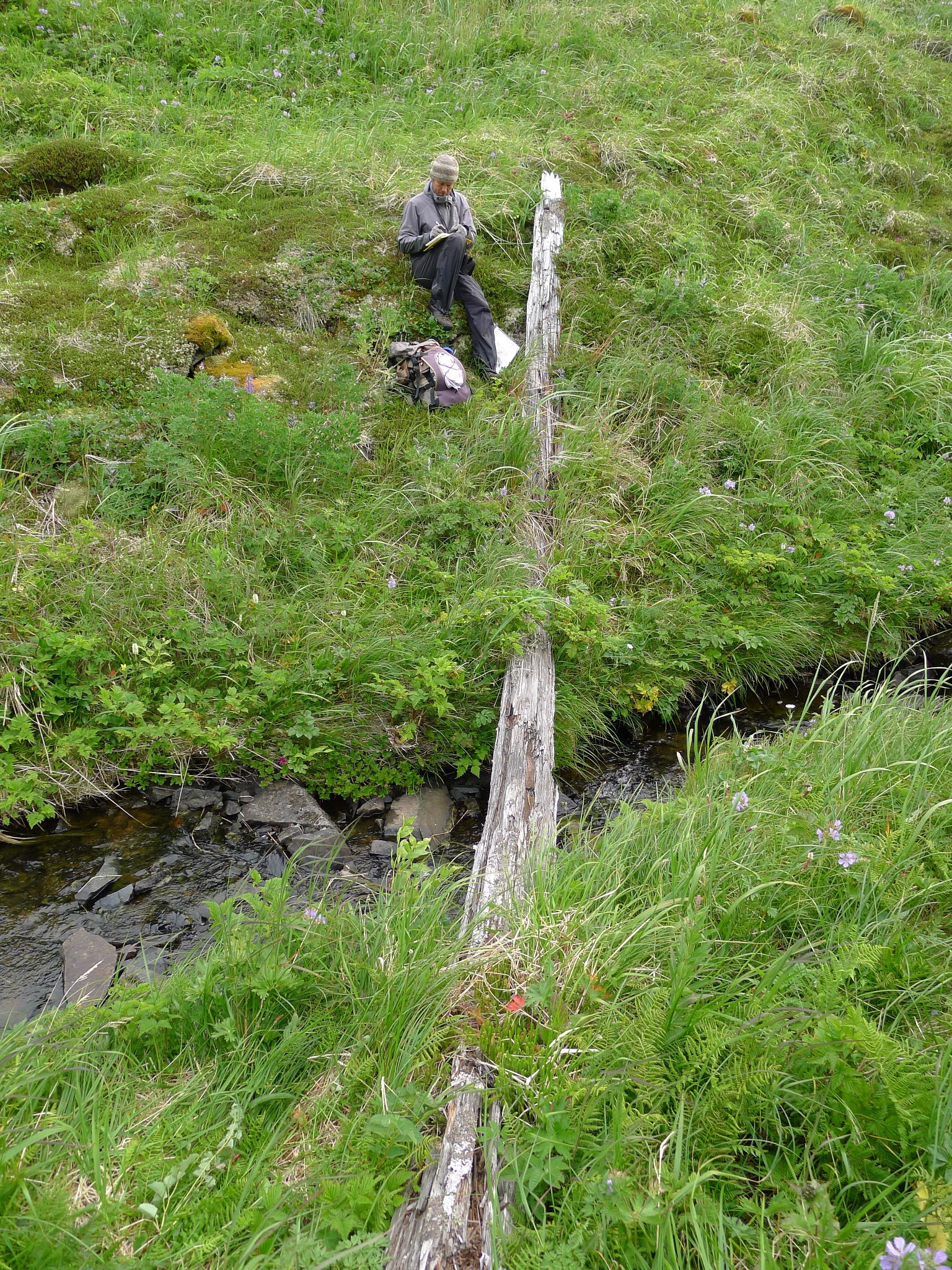
A geologist takes field notes to document the discovery of a 9 m (30 feet) long driftlog stranded more than 805 m (0.5 mi) inland at Stardust Bay on the remote Alaskan island of Sedanka.
The log, stranded at an elevation of more than 18 meters (60 feet) above sea level, was carried inland and deposited in 1957 by a large tsunami generated by the magnitude 8.6 Andreanof Islands earthquake. The elevation of the driftlog provides an estimate of the minimum runup of tsunami waves. Stardust Bay, Sedanka Island, Alaska
Credit: Richard Koehler
WASHINGTON, DC — New evidence for frequent large tsunamis at a remote island near Dutch Harbor, Alaska provides geological data to aid tsunami hazard preparedness efforts around the Pacific Rim. Recent fieldwork in Alaska's Aleutian Islands suggests that a presently "creeping" section of the Aleutian Subduction Zone fault could potentially generate an earthquake great enough to send a large tsunami across the Pacific to Hawaii.
These findings, published by a team of scientists led by U.S. Geological Survey geologist Rob Witter in Geophysical Research Letters, a journal of the American Geophysical Union, present strong evidence for prehistoric tsunamis in the Aleutian Islands, and call for a reevaluation of earthquake and tsunami hazards along this part of the eastern Aleutian Subduction Zone.
Creeping faults exhibit slow, continuous motion along them. Because the two tectonic plates are not fully locked by friction, it is unclear whether or not creeping faults can host large earthquakes. Geological observations at Stardust Bay, Alaska point toward previously unrecognized tsunami sources along a presently creeping part of the Aleutian Subduction Zone.
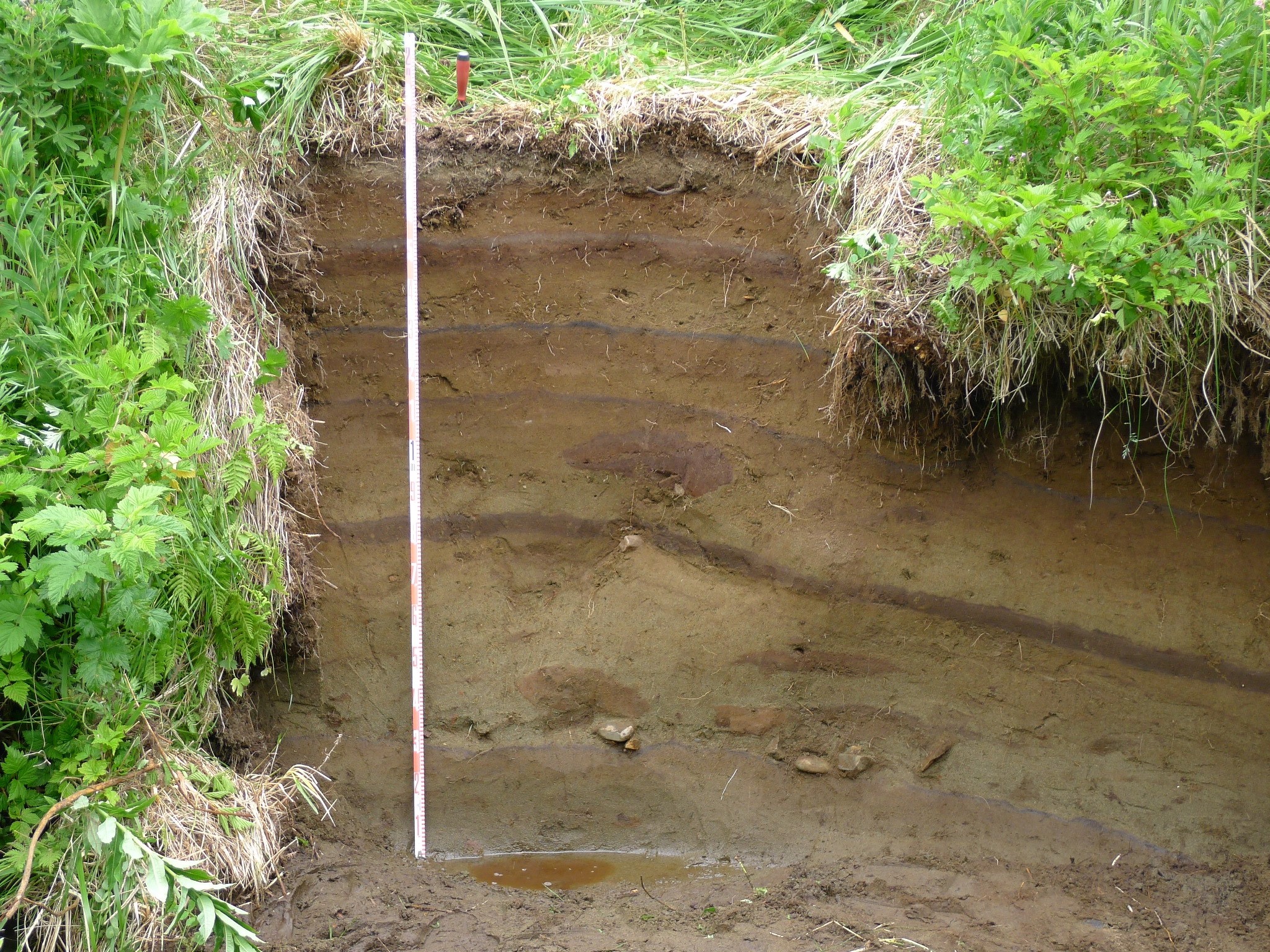
An outcrop composed of six tsunami deposits on the inland side of the lowland backing Stardust Bay over 805 m (0.5 miles) from the sea. Brown soils developed into the top of each sand sheet and black tephra (air fall volcanic ash) layers between two of the sand deposits aided correlation of the six sand sheets across the study area.
Credit: Richard Koehler
Prevailing scientific models about earthquake generation are challenged when it comes to forecasting earthquake probabilities where observations indicate a creeping megathrust (the gently-dipping fault between converging tectonic plates, where one plate is thrust below the other). Usually, scientific models forecast the highest seismic hazard where the tectonic plates are locked together. The study site, Stardust Bay, faces a creeping part of the eastern Aleutian Subduction Zone, which is sandwiched between the rupture areas of historical earthquakes in 1946 and 1957 that generated tsunamis with devastating consequences to coastal communities around the Pacific Ocean. This study is the first to identify geological evidence for repeated prehistoric tsunamis along a creeping part of the eastern Aleutian subduction zone located between the 1946 and 1957 earthquakes.
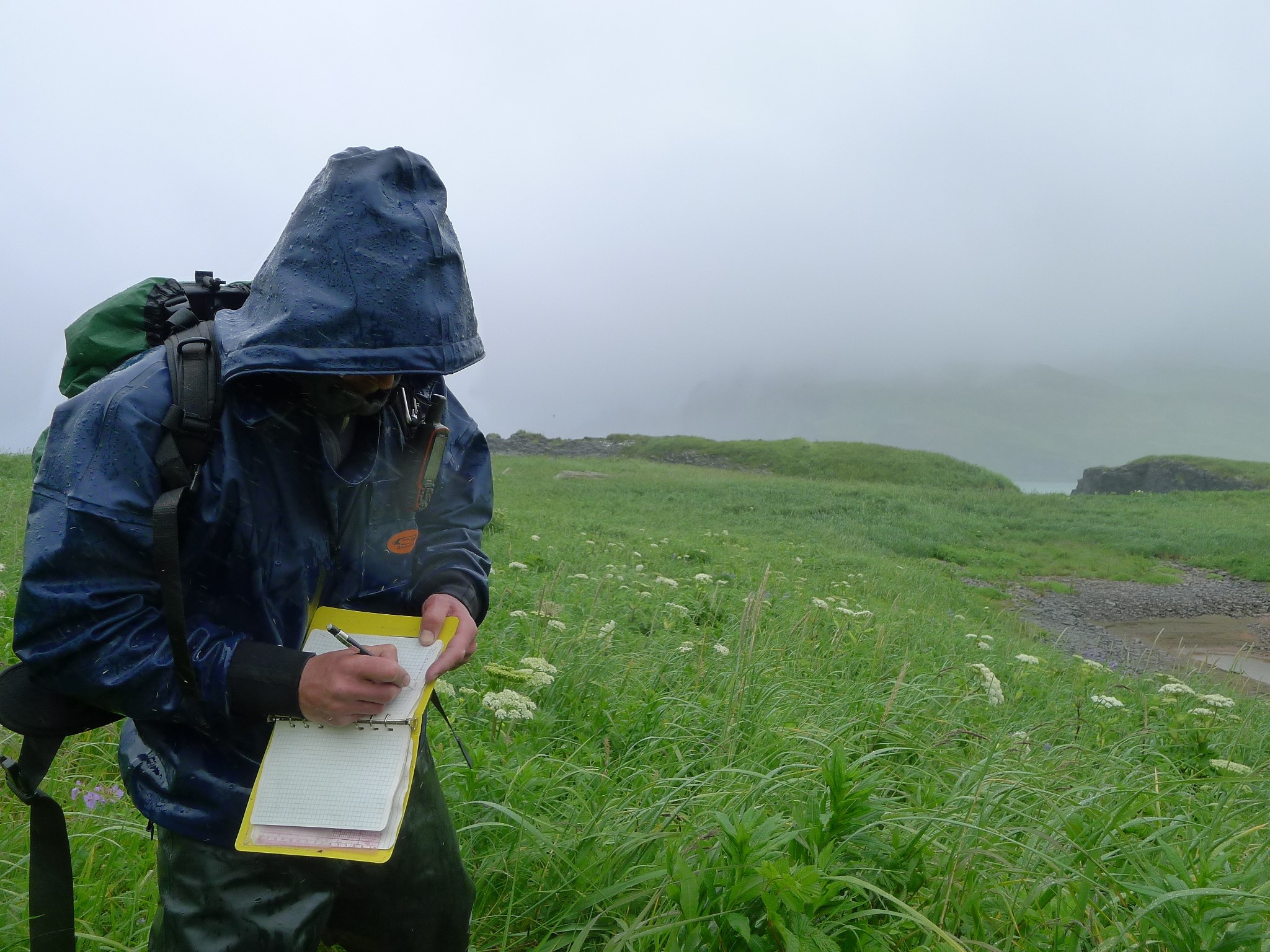
USGS Geologist Robert Witter documenting tsunami scour features near Stardust Bay, Alaska. Conditions in the Aleutian Islands can be wet and windy for days on end.
Credit: Richard Koehler
The new evidence includes six sand sheets deposited up to 15 meters (or 50 feet) above sea level by past large tsunamis that probably were generated by great Aleutian earthquakes, and indicate a previously unknown tsunami source that poses a new hazard to the Pacific basin.
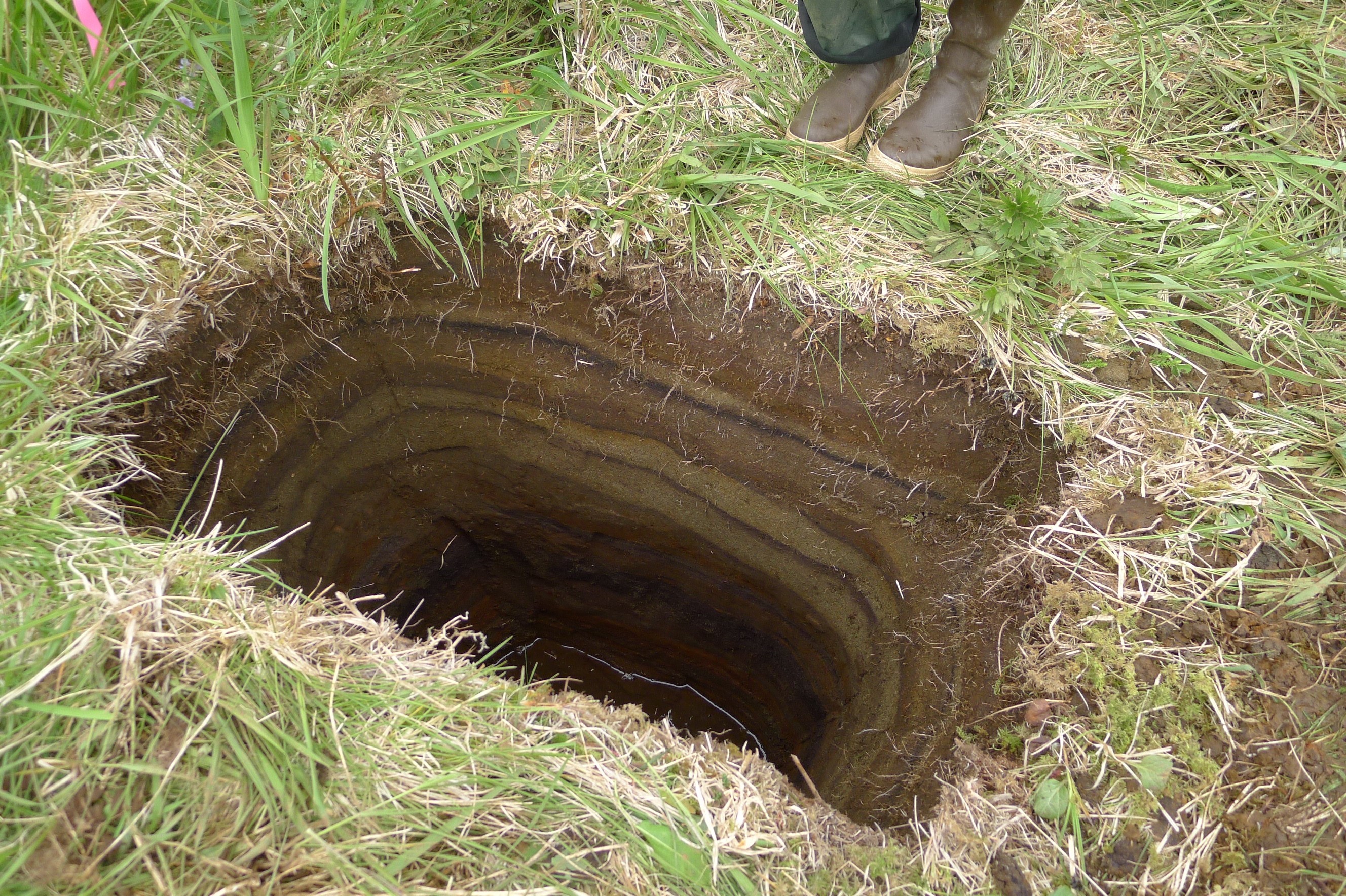
On a ridge behind Stardust Bay at an elevation of 14 m (46 feet) above sea level, a shallow pit reveals five sand sheets deposited by tsunamis in the past 1700 years.
Credit: Robert Witter, USGS
Using hand-driven cores, augers, and shovels to reveal the sediments blanketing a lowland facing the Pacific Ocean, and using radiocarbon dating to estimate the times of sand sheet deposition, scientists established a geologic history of past large tsunamis. The youngest sand sheet and modern drift logs stranded as far as 805 meters, or half a mile, inland and 18 meters (or 60 feet) above sea level record a large tsunami triggered by the magnitude 8.6 Andreanof Islands earthquake in 1957. Older sand sheets resulted from tsunamis that may have been even larger than the 1957 tsunami. The oldest tsunami sand layer was deposited approximately 1700 years ago, and the average interval between tsunami deposits is 300–340 years.
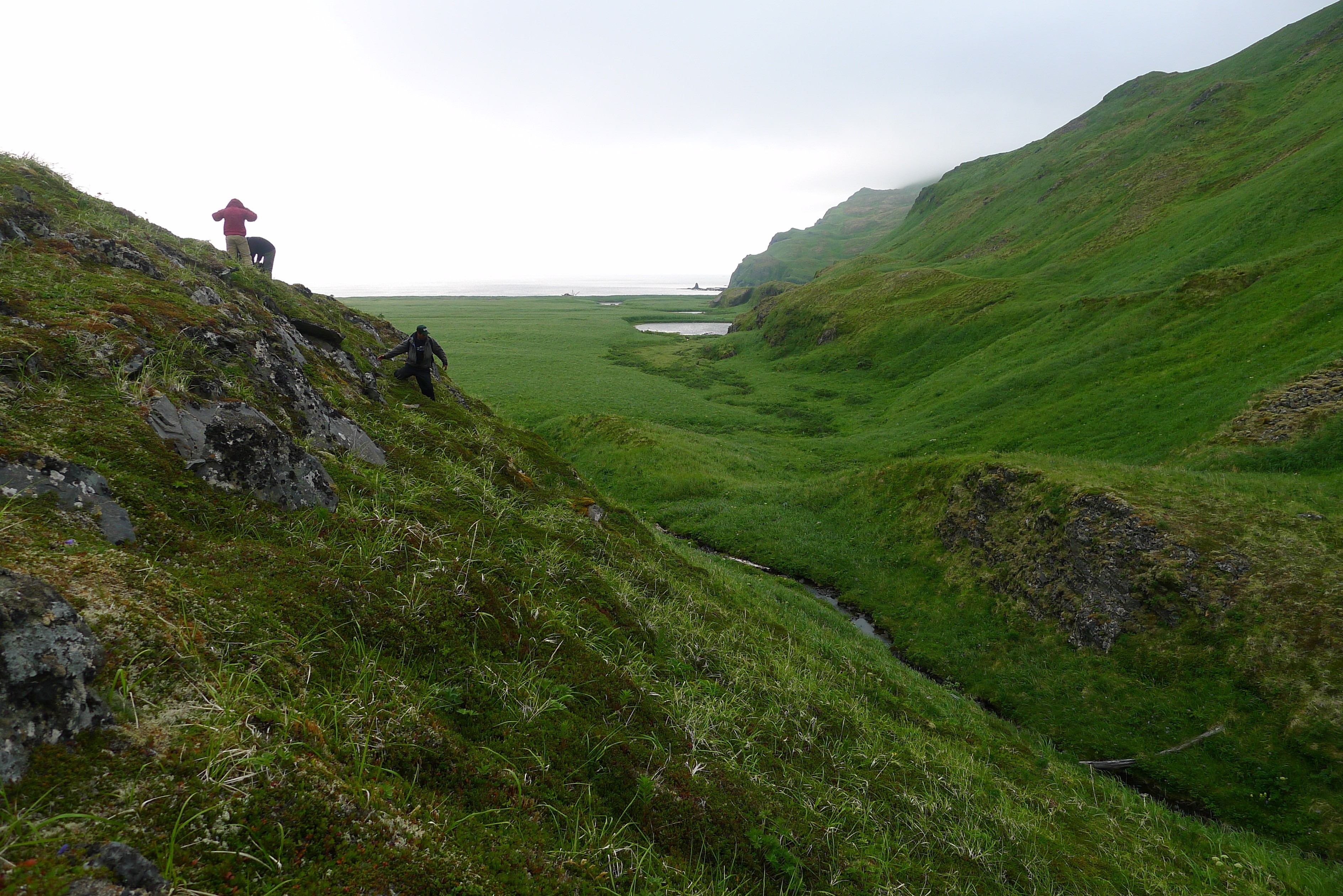
Three geologists scramble down a hillside on Sedanka Island that overlooks Stardust Bay. The geologists documented driftlogs stranded at elevations up to 60 m (196 feet) above sea level and over 804 m (.5 mile) inland.
The driftlogs, one visible in the lower right of the photo, were probably carried inland and deposited in 1957 by a tsunami generated by the magnitude 8.6 Andreanof Islands earthquake.
Credit: Robert Witter, USGS
These geological observations indicate large tsunamis in the eastern Aleutians have recurred every 300–340 years on average, and provide additional field-based information that is relevant to new tsunami evacuation zone maps for Hawaii.
Source: https://news.agu.org/press-release/new-geological-evidence-aids-tsunami-hazard-assessments-from-alaska-to-hawaii/Read my blog at http://eclecticarcania.blogspot.com/
My Facebook: http://www.facebook.com/derkimster
Linkedin profile: http://www.linkedin.com/pub/kim-noyes/9/3a1/2b8
Follow me on Twitter @CalDisasters
| | This email has been sent from a virus-free computer protected by Avast. www.avast.com |
__._,_.___
No comments:
Post a Comment