Sunday, September 29, 2019

[CaliforniaDisasters] Machine learning predicts how big wildfires will get

A new technique can predict the final size of wildfires from the moment of ignition, researchers report.

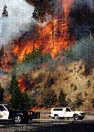
Credit: San Bernardino Nat'l Forest/Flickr


Built around a machine learning algorithm, the model can help forecast whether a wildfire will be small, medium, or large by the time it has run its course—knowledge useful to those in charge of allocating scarce firefighting resources.

"A useful analogy is to consider what makes something go viral in social media," says lead author Shane Coffield, a doctoral student in earth system science at the University of California, Irvine. "We can think about what properties of a specific tweet or post might make it blow up and become really popular—and how you might predict that at the moment it's posted or right before it's posted."

Many wildfires at once

The researchers applied that thinking to a hypothetical situation in which dozens of fires break out simultaneously. It sounds extreme, but this scenario has become all too common in recent years in parts of the western United States as climate change has resulted in hot and dry conditions on the ground that can put a region at high risk of ignition.

"Only a few of those fires are going to get really big and account for most of the burned area, so we have this new approach that's focused on identifying specific ignitions that pose the greatest risk of getting out of control," Coffield says.

The team used Alaska as a study area for the project because a rash of concurrent fires in its boreal forests has plagued the state over the past decade, threatening human health and vulnerable ecosystems.

At the core of the new model is a "decision tree" algorithm. By feeding it climate data and crucial details about atmospheric conditions and the types of vegetation present around the starting point of a fire, the researchers could predict the final size of a blaze 50% of the time. A key variable is the vapor pressure deficit—just how little moisture there is in the area—during the first six days of a fire's existence. A second major consideration for Alaskan forests is the percentage of trees of the black spruce variety.

"Black spruce, which are dominant in Alaska, have these long, droopy branches that are designed—from an evolutionary perspective—to wick up fire," says coauthor James Randerson, professor and chair in earth system science. "Their seeds are adapted to do well in a post-fire environment, so their strategy is to kill off everything else around them during a fire to reduce competition for their offspring."

Randerson says Coffield was able to show that the fraction of black spruce within a 2.5-mile radius of the ignition site is an important factor in judging how big a fire will grow.

Speedy predictions

One advantage of this new method is speed, Coffield says. The algorithm "learns" with each new data point and can quickly figure out the critical thresholds for identifying large fires. It's possible for people to do this manually or by running simulations on each different ignition, he says, but the machine learning system's statistical approach is "really much faster and more efficient, especially for considering multiple fires simultaneously."

Faced with a climate change-induced jump in the number of wildfires expected each season, state, county, and local firefighting authorities could benefit from some updated tools and techniques, Randerson notes. In addition to potentially saving lives and protecting property and crucial infrastructure, fire suppression efforts will also become increasingly important in preserving the natural world.

"In places like Alaska, there's a need to limit the area affected by fire, because if we keep having these unusual, high-fire years, more carbon will be lost from the landscape, exacerbating warming," Randerson says. "If we let the fires run away, we could be in a situation where there's a lot of significant damage to both the climate system and ecosystems."

The study appears in the International Journal of Wildland Fire. The UC Irvine's Machine Learning and Physical Sciences program and the National Science Foundation supported the research.

Source: UC Irvine

Original Study DOI: 10.1071/WF19023


--
_._,_._,_

Groups.io Links:

You receive all messages sent to this group.

View/Reply Online (#32397) | Reply To Group | Reply To Sender | Mute This Topic | New Topic

Your Subscription | Contact Group Owner | Unsubscribe [volcanomadness1@gmail.com]

_._,_._,_

[CaliforniaDisasters] South Ops News & Notes Update (9/29/2019-6:20PM)

Glossary:
DPA = Direct Protection Area
FRA = Federal Responsibility Area
SRA = State Responsibility Area

Date
Time
News and Notes
09/29/2019 1820

Federal

Taboose, Vegetation Fire, Inyo County, Update
9 miles south of Big Pine
Federal/State DPA, FRA/SRA, Inyo National Forest

  • 10,296 acres (+0 acres), grass and brush, 75% contained (+0% containment)
  • Minimal fire behavior with creeping and smoldering
  • Area closures remain in effect
  • Incident submitting 1 ICS-209 daily at 1800

Schaeffer, Vegetation Fire, Tulare County, Update
20 miles north of Kernville
Federal DPA, FRA Sequoia National Forest

  • 230 acres (+0 acres), grass and brush, 35% contained (+0% containment)
  • Moderate fire behavior with backing and flanking
  • Incident submitting 1 ICS-209 daily at 1800
09/29/2019 0800

Federal

Taboose, Vegetation Fire, Inyo County, Update
9 miles south of Big Pine
Federal/State DPA, FRA/SRA, Inyo National Forest

  • 10,296 acres (+0 acres), grass and brush, 75% contained (+0% containment)
  • Minimal fire behavior with creeping and smoldering
  • Area closures remain in effect
  • Incident submitting 1 ICS-209 daily at 1800

Schaeffer, Vegetation Fire, Tulare County, Update
20 miles north of Kernville
Federal DPA, FRA Sequoia National Forest

  • 230 acres (+25 acres), grass and brush, 35% contained (+10% containment)
  • Moderate fire behavior with backing and flanking
  • Incident submitting 1 ICS-209 daily at 1800
09/28/2019 1740

Federal

Taboose, Vegetation Fire, Inyo County, Update
9 miles south of Big Pine
Federal/State DPA, FRA/SRA, Inyo National Forest

  • 10,296 acres (+0 acres), grass and brush, 75% contained (+0% containment)
  • Minimal fire behavior with creeping and smoldering
  • Area closures remain in effect
  • Incident submitting 1 ICS-209 daily at 1800

Schaeffer, Vegetation Fire, Tulare County, Update
20 miles north of Kernville
Federal DPA, FRA Sequoia National Forest

  • 230 acres (+25 acres), grass and brush, 35% contained (+10% containment)
  • Moderate fire behavior with backing and flanking
  • Incident submitting 1 ICS-209 daily at 1800
09/28/2019 0725

Federal

Taboose, Vegetation Fire, Inyo County, Update
9 miles south of Big Pine
Federal/State DPA, FRA/SRA, Inyo National Forest

  • 10,296 acres (+0 acres), grass and brush, 75% contained (+0% containment)
  • Minimal fire behavior with creeping and smoldering
  • Area closures remain in effect
  • Incident submitting 1 ICS-209 daily at 1800

Schaeffer, Vegetation Fire, Tulare County, Update
20 miles north of Kernville
Federal DPA, FRA Sequoia National Forest

  • 205 acres (+0 acres), grass and brush, 25% contained (+0% containment)
  • Moderate fire behavior
  • Incident submitting 1 ICS-209 daily at 1800
09/27/2019 1745

Federal

Taboose, Vegetation Fire, Inyo County, Update
9 miles south of Big Pine
Federal/State DPA, FRA/SRA, Inyo National Forest

  • 10,296 acres (+0 acres), grass and brush, 75% contained (+0% containment)
  • Minimal fire behavior with creeping and smoldering
  • Area closures remain in effect
  • Incident submitting 1 ICS-209 daily at 1800

Schaeffer, Vegetation Fire, Tulare County, Update
20 miles north of Kernville
Federal DPA, FRA Sequoia National Forest

  • 205 acres (+8 acres), grass and brush, 25% contained (+9% containment)
  • Moderate fire behavior
  • Incident submitting 1 ICS-209 daily at 1800

Lopez, Vegetation Fire, San Luis Obispo County, Final
Upper Lopez Canyon Rd, 14 miles southeast of San Luis Obispo
State/Federal DPA, SRA/FRA, San Luis Obispo Unit/Los Padres National Forest

  • 220 acres (+0 acres), grass, 100% contained (+10% containment)
  • Minimal fire behavior
  • Last report unless significant changes occur
09/27/2019 0725

Federal

Taboose, Vegetation Fire, Inyo County, Update
9 miles south of Big Pine
Federal/State DPA, FRA/SRA, Inyo National Forest

  • 10,296 acres (+0 acres), grass and brush, 75% contained (+0% containment)
  • Minimal fire behavior with creeping and smoldering
  • Area closures remain in effect
  • Incident submitting 1 ICS-209 daily at 1800

Schaeffer, Vegetation Fire, Tulare County, Update
20 miles north of Kernville
Federal DPA, FRA Sequoia National Forest

  • 197 acres (+0 acres), grass and brush, 16% contained (-4% containment)
  • Minimal fire behavior
  • Incident submitting 1 ICS-209 daily at 1800

Lopez, Vegetation Fire, San Luis Obispo County, Update
Upper Lopez Canyon Rd, 14 miles southeast of San Luis Obispo
State/Federal DPA, SRA/FRA, San Luis Obispo Unit/Los Padres National Forest

  • 220 acres (+0 acres), grass, 90% contained (+0% containment)
  • Minimal fire behavior
09/26/2019 1850

Federal

Taboose, Vegetation Fire, Inyo County, Update
9 miles south of Big Pine
Federal/State DPA, FRA/SRA, Inyo National Forest

  • 10,296 acres (+0 acres), grass and brush, 75% contained (+0% containment)
  • Minimal fire behavior with creeping and smoldering
  • Area closures remain in effect
  • Incident submitting 1 ICS-209 daily at 1800

Schaeffer, Vegetation Fire, Tulare County, Update
20 miles north of Kernville
Federal DPA, FRA Sequoia National Forest

  • 197 acres (+7 acres), grass and brush, 20% contained (+5% containment)
  • Minimal fire behavior
  • Incident submitting 1 ICS-209 daily at 1800

Cow, Vegetation Fire, Tulare County, Update
Golden Trout Wilderness, 13 miles west of Olancha
Federal DPA, FRA Inyo National Forest

  • 2,025 (+0) acres, grass and brush, 90% contained (+0% containment)
  • Minimal fire behavior with smoldering

Lopez, Vegetation Fire, San Luis Obispo County, Update
Upper Lopez Canyon Rd, 14 miles southeast of San Luis Obispo
State/Federal DPA, SRA/FRA, San Luis Obispo Unit/Los Padres National Forest

  • 220 acres (+0 acres), grass, 90% contained (+5% containment)
  • Minimal fire behavior
09/26/2019 0715

Unified Command

Lopez, Vegetation Fire, San Luis Obispo County, Update
Upper Lopez Canyon Rd, 14 miles southeast of San Luis Obispo
State/Federal DPA, SRA/FRA, San Luis Obispo Unit/Los Padres National Forest

  • 220 acres (+0 acres), grass, 85% contained (+0% containment)
  • Minimal fire behavior
  • Unified command with USFS and CALFIRE
  • Transitioning out of Unified Command tomorrow at 0800

Federal

Taboose, Vegetation Fire, Inyo County, Update
9 miles south of Big Pine
Federal/State DPA, FRA/SRA, Inyo National Forest

  • 10,296 acres (+0 acres), grass and brush, 75% contained (+0% containment)
  • Minimal fire behavior with creeping and smoldering
  • Area closures remain in effect
  • Incident submitting 1 ICS-209 daily at 1800

Schaeffer, Vegetation Fire, Tulare County, Update
20 miles north of Kernville
Federal DPA, FRA Sequoia National Forest

  • 190 acres (+0 acres), grass and brush, 15% contained (+0% containment)
  • Minimal fire behavior
  • Incident submitting 1 ICS-209 daily at 1800
09/25/2019 1807

Unified Command

Lopez, Vegetation Fire, San Luis Obispo County, Update
Upper Lopez Canyon Rd, 14 miles southeast of San Luis Obispo
State/Federal DPA, SRA/FRA, San Luis Obispo Unit/Los Padres National Forest

  • 220 acres (+0 acres), grass, 85% contained (+15% containment)
  • Minimal fire behavior
  • Unified command with USFS and CALFIRE
  • Transitioning out of Unified Command tomorrow at 0800

Federal

Taboose, Vegetation Fire, Inyo County, Update
9 miles south of Big Pine
Federal/State DPA, FRA/SRA, Inyo National Forest

  • 10,296 acres (+0 acres), grass and brush, 75% contained (+0% containment)
  • Minimal fire behavior with creeping and smoldering
  • Area closures remain in effect
  • Incident submitting 1 ICS-209 daily at 1800

Schaeffer, Vegetation Fire, Tulare County, Update
20 miles north of Kernville
Federal DPA, FRA Sequoia National Forest

  • 190 acres (+5 acres), grass and brush, 15% contained (+0% containment)
  • Minimal fire behavior
  • Incident submitting 1 ICS-209 daily at 1800

State

Dehesa, Vegetation Fire, San Diego County, Final
Dehesa Road x Sloan Canyon Road, Sycuan
State DPA, SRA/FRA, San Diego Unit /Cleveland National Forest /Sycuan Indian Reservation

  • 200 acres (+0 acres), grass, 75% contained (+54% contained)
  • Last report unless significant activity occurs
09/25/2019 1800

South Ops will be decreasing to PL2 MACS Level 2 effective today at 1800 due to weather conditions and resource health.

Source: https://gacc.nifc.gov/oscc/news.php
_._,_._,_

Groups.io Links:

You receive all messages sent to this group.

View/Reply Online (#32396) | Reply To Group | Reply To Sender | Mute This Topic | New Topic

Your Subscription | Contact Group Owner | Unsubscribe [volcanomadness1@gmail.com]
_._,_._,_

[CaliforniaDisasters] North Ops News & Notes Update (9/28/2019-6PM)

Glossary:
KNF = Klamath National Forest
PNF = Plumas National Forest
SHF = Shasta-Trinity National Forest

     
Dates
Time
News and Notes
09/28/2019 1800 CA-SHF South Fire: 5,405 acres, 62% contained. Road and trail closures remain in effect for the fire area. There is a threat to prehistoric trails, historic sites, and endangered Salmon. Fire may impact a Class 1 Airshed within the Yolla Bolla Wilderness.
09/28/2019 0830 CA-SHF South Fire: 5,405 acres, 62% contained. Recent increase in fire size is due to more accurate mapping. Road and trail closures remain in effect for the fire area. There is a threat to prehistoric trails, historic sites, and endangered Salmon. Fire may impact a Class 1 Airshed within the Yolla Bolla Wilderness. Transition to a Type 4 Incident Management Team occurred this morning.
09/27/2019 1800 CA-SHF South Fire: 5,255 acres, 62% contained. Minimal fire behavior today. Road and trail closures are in effect for the fire area. There is a threat to prehistoric trails, historic sites, and endangered Salmon. Fire may impact a Class 1 Airshed within the Yolla Bolla Wilderness.
09/27/2019 1130 National Preparedness Level to PL 1 at 1100 PST due to current and predicted weather, adequate resource availability and decreasing potential for emerging significant wildland fires in multiple geographic areas.
09/27/2019 0800 CA-SHF South Fire: 5,253 acres, 62% contained. Moderate fire behavior late yesterday helped push the fire west towards a previously burned area. Road and trail closures are in effect for the fire area. There is a threat to prehistoric trails, historic sites, and endangered Salmon. Fire may impact a Class 1 Airshed within the Yolla Bolla Wilderness.
09/26/2019 1800 CA-SHF South Fire: 5,253 acres, 62% contained. Road and trail closures are in effect for the fire area. There is a threat to prehistoric trails, historic sites, and endangered Salmon. Fire may impact a Class 1 Airshed within the Yolla Bolla Wilderness.
09/25/2019 1800 CA-KNF Lime Fire: 1,872 acres 100% contained.
09/25/2019 1800 CA-SHF South Fire: 5,253 acres, 62% contained. Road and trail closures are in effect for the fire area. There is a threat to prehistoric trails, historic sites, and endangered Salmon. Fire may impact a Class 1 Airshed within the Yolla Bolla Wilderness.
09/25/2019 1800 CA-PNF Walker Fire: 54,612 acres, 100% contained.
Source: https://gacc.nifc.gov/oncc/news.php
_._,_._,_

Groups.io Links:

You receive all messages sent to this group.

View/Reply Online (#32395) | Reply To Group | Reply To Sender | Mute This Topic | New Topic

Your Subscription | Contact Group Owner | Unsubscribe [volcanomadness1@gmail.com]

_._,_._,_

[CaliforniaDisasters] On This Date In California Weather History (September 29)

1990: An observer at the Barstow-Daggett Airport reported a tornado touched down briefly.

1982: Snow also fell in Dyer, NV (east of Mammoth Lakes near CA-NV border), where 2" was measured, establishing an all-time September record for this station and marking the only instance of measurable snow in September here.
2" also fell in Goldfield, NV, (just east of CA-NV border).
A trace of snow fell on Mount Charleston in Kyle Canyon (NW of Las Vegas, NV, near CA-NV border).

1982: Greatest daily September snowfall on record in Reno, NV, with 1.5" measured.

1976: Pinnacles National Monument (Monterey Co.) received 1.18" of rain.


1976:
Thunderstorms struck the central and southern San Joaquin Valley with up to 2-1/2" of rain falling in some areas.
Dramatic lightning displays were seen from Fowler to Delano and marble size hail fell in Visalia and Porterville.
The storm knocked out power to several thousand customers and also struck two F-106s airplanes operated by the Fresno Air National Guard causing burn marks on the planes. The heavy rain also caused a roof to collapse at a building under construction as well as flooded homes, businesses and streets.
It also caused additional damage to crops that were seriously affected by the rain associated with Tropical Depression Kathleen.

1970: Drought in Southern California climaxed and hot Santa Ana winds blew starting on 9/25 and ending on 9/30.
Winds peaked at 60 mph at Cuyamaca.
The winds downed powerlines, which sparked the Laguna Fire, one of the largest wildfires in California history.
8 people were killed, 382 homes were destroyed, and 175,425 acres were burned.
The fire consumed whole communities of interior San Diego County.
500,000 acres were burned and caused $50 million in damage.

1965: The morning low temperature at Reno, NV was 23° F.

1946: A tropical storm moved northward into northern Baja California and dissipated.
Moisture from this system produced a particular cloudburst of 3" in 30 minutes in San Bernardino.
Around San Bernardino farmlands, orchards and vineyards were eroded and some roads were damaged.
Many homes were flooded.

1932: Heavy rains starting on 9.28 and ending on 10.1 came from a dying tropical cyclone.
It brought flooding to parts of the mountains and deserts of Southern California.
4.38" of rain fell at Tehachapi in 7 hours on 9.30.
Floods in Tehachapi resulted in 15 deaths.

1921: A tropical storm crossed the Baja peninsula southwest of Yuma, AZ, and moved up the Colorado River Valley.
Several stations along the Colorado River reported in excess of 3" of rain, including 3.65" at Yuma.
Other amounts included 1.50" at Flagstaff, 1.24" at Prescott, 0.68" at Tucson, and 0.56" at Phoenix, AZ.

1894: San Francisco received 0.68" of rain.

1890: 1.12" of rain falls in Fresno, tying the highest calendar day amount on record for the month of September last set on September 26, 1898.

Source: NWS San Francisco/Monterey, Hanford, Reno, Las Vegas, Phoenix, & San Diego

--
_._,_._,_

Groups.io Links:

You receive all messages sent to this group.

View/Reply Online (#32394) | Reply To Group | Reply To Sender | Mute This Topic | New Topic

Your Subscription | Contact Group Owner | Unsubscribe [volcanomadness1@gmail.com]

_._,_._,_

[CaliforniaDisasters] 1992 Cleveland Fire Anniversary - Sun, 09/29/2019 #cal-notice

1992 Cleveland Fire Anniversary

When:
Sunday, 29 September 2019

Where:
Sierra Nevada - El Dorado County

Description:
The Cleveland Fire began on a hot and breezy Fall afternoon. A small five-foot diameter fire was reported at noon on September 29 in the vicinity of the Cleveland Corral Visitor Information Station, eight miles east of Pollock Pines.


1992 Cleveland Fire (Eldorado National Forest)
Within seven minutes of the report, two Forest Service helicopters, a fire engine, and a hand crew were at the fire and the fire was already 15 acres in size. Four minutes later the fire was estimated at 75 acres in size, spreading in the crowns of the trees and creating spot fires 1/4 mile away.

The Cleveland fire burned aggressively for the first three days, burning 4,500 acres the first day and almost 14,000 acres the second day. On the third day, tragedy struck and a fire retardant tanker plane crashed. Two pilots gave their lives that day while trying to stop the aggressively moving fire. Fortunately, after burning another 3,500 acres that day, it began to lightly rain in the evening. It was another 13 days before the fire was declared controlled, on October 14, 1992 at a total size of 22,485 acres. Half of the burned area was public land and the majority of the rest was private commercial timberland. top


In all, some 5,300 firefighters and support personnel from over 130 different cooperating agencies and groups worked on the fire. The fire was terribly costly. Besides the two lives lost and the millions of dollars of timber resources consumed in the fire, 41 dwellings and several outbuildings, and several pieces of logging and construction equipment were burned. In addition, the El Dorado Canal, supplying water to the local communities of Pollock Pines and Camino, was severely damaged. Highway 50, the main travel route to South Lake Tahoe, was closed for several weeks resulting in losses in regional economic revenue. The environmental costs were also tremendous. The fire killed almost all trees over most of the fire area, immediately removing wildlife habitat for forest dwelling animals and increasing the stress on fragile watersheds.

Source: http://eldoradocounty.net/clevelandfire.html

_._,_._,_

Groups.io Links:

You receive all messages sent to this group.

View/Reply Online (#32393) | Reply To Group | Reply To Sender | Mute This Topic | New Topic
Mute #cal-notice
Your Subscription | Contact Group Owner | Unsubscribe [volcanomadness1@gmail.com]

_._,_._,_

Saturday, September 28, 2019

[CaliforniaDisasters] On This Date In California Weather History (September 28)

2005: A strong Santa Ana Wind event raked Southern California on this date and drove a small fire which began along Topanga Canyon Boulevard (SR 27) in the Chatsworth area of the Santa Susana Mountains over several thousand acres today and over 16,000 acres today and tomorrow.
The Topanga Fire ultimately consumed 24,175 acres and several homes and businesses.

1994: A total of 1.25" or rain fell in Bishop, CA, which was the greatest one day rainfall in September.

1973: Strong Santa Ana winds with peak gusts to 90 mph swept through the canyons and passes of Ventura, Los Angeles, and San Bernardino Counties. The winds brought very dry conditions and helped fan 16 brush fires. 

1971:
Lowest reading ever at Lodgepole (Sequoia/Kings Canyon NP) in September, 19° F.

1970: Drought in Southern California climaxed and hot Santa Ana winds blew starting on 9/25 and ending on 9/30.
Winds peaked at 60 mph at Cuyamaca.
The winds downed powerlines, which sparked the Laguna Fire, one of the largest wildfires in California history.
Eight people were killed, 382 homes were destroyed, and 175,425 acres were burned.
The fire consumed whole communities of interior San Diego County.Oceanside Harbor hit 99°, the highest temperature on record.

1967: Strong thunderstorms rolled across Southern California with unusually intense lightning and heavy rains.
Lightning strikes started numerous wildfires and ruptured a chlorine tank. The resulting gas spill injured 73 people.
Flooding in Palm Springs caused significant damage to the carrot crop. 

1966: San Francisco had a high of 95° F.

1966: Pismo Beach hit 100° F establishing a monthly high temperature mark.

1963: Laguna Beach reached 104°, tying the same value from 1939 for the highest temperature on record there. 

1932: Heavy rains starting on this day and ending on 10.1 came from a dying tropical cyclone.
It brought flooding to parts of the mountains and deserts of Southern California.
4.38" of rain fell at Tehachapi in seven hours on 9.30.
Floods in Tehachapi resulted in 15 deaths.

1926:  A wildfire threatened Carson City, NV.
Five firefighters were killed when they were trapped by flames in Clear Creek Canyon.

1921: A tropical storm crossed the Baja peninsula southwest of Yuma, AZ, and moved up the Colorado River Valley.
Several stations along the Colorado River reported in excess of 3" of rain, including 3.65" at Yuma.
Other amounts included 1.50" at Flagstaff, 1.24" at Prescott, 0.68" at Tucson, and 0.56" at Phoenix, AZ.

1918: Susanville recorded 1.37" of precipitation.

Source: NWS San Francisco/Monterey, Hanford, Reno, Las Vegas, Phoenix, & San Diego

--
_._,_._,_

Groups.io Links:

You receive all messages sent to this group.

View/Reply Online (#32392) | Reply To Group | Reply To Sender | Mute This Topic | New Topic

Your Subscription | Contact Group Owner | Unsubscribe [volcanomadness1@gmail.com]

_._,_._,_

[CaliforniaDisasters] On This Date In California Weather History (September 27)

2014: A thunderstorm in the Death Valley area caused flashflooding that covered Highway 190 near mile marker 66 southwest of Furnace Creek. Baseball and softball sized cobbles covered the roadbed.

2010: Strong high pressure and offshore flow led to record high temperatures for many stations.
Los Angeles reached their all-time high temperature of 113° F, breaking the record of 112° F held for 20 years that was set on 6/26/1990.
Santa Ana's 112° F just missed the all-time mark by one degree.
Numerous high temperature records for the month of September were broken.
This fall heat followed the coolest summer since 1933.

2009: The Power fire in Sequoia National Forest, ignited on September 27th early in the morning.
The cause was unknown.
The location was Highway 190 near Springville in Tulare County.
The size was 400 acres.
The fire was contained on September 29th at a cost of $500,000.

1998: A funnel cloud was observed over Mission Beach.

1997: The remains of Hurricane Nora moves up the Colorado river.
The center of the storm passes directly over Yuma, AZ, where winds gust as high as 54 mph.
Significant flooding occurs across western Arizona.
11.97" of rain falls in 24 hours on top of Harquahala Mountain breaking the 24 hour record of 11.40" set at Workman Creek in the 1970 Labor Day Storm. 4.06" of rain falls at the Yuma Airport.
The average annual rainfall in Yuma is 3.17". 

1986: It was 49° F in Borrego Springs, the lowest temperature on record for September.
This also occurred on 9.30.1982 and 9.30.1971.

1983: Two funnel clouds were sighted in North Las Vegas, NV.

1970: Drought in Southern California climaxed and hot Santa Ana winds blew starting on 9/25 and ending on 9/30.
Winds peaked at 60 mph at Cuyamaca.
The winds downed powerlines sparking the Laguna Fire, one of the largest wildfires in California history.
Eight were killed, 382 homes were destroyed, and 175,425 acres were burned.
The fire consumed whole communities of interior San Diego County.  

1948: The low temperature of 43° F in Las Vegas, NV, sets the all-time coolest September reading.

1948: Priest Valley had a low temperature of 26° F.

1945: The morning low temperature at Reno, NV, was 25° F.

1939: It was 30° F in Victorville, the lowest temperature on record for September.

1924: It was 38° F in Escondido, the lowest temperature on record for September.

1921: A tropical storm crossed the Baja peninsula southwest of Yuma and moved up the Colorado River Valley.
Several stations along the Colorado River reported in excess of 3" of rain, including 3.65" at Yuma, AZ.
Other amounts included 1.50" at Flagstaff, 1.24" at Prescott, 0.68" at Tucson, and 0.56" at Phoenix, AZ.

1908: Bakersfield set its' record low for the month of September, 30° F.

1888: Fresno reaches 105° for a high, the 14th time all month that a triple digit high was recorded here during the month of September.
This set a record for the most triple digit highs in the month of September.

Source: NWS San Francisco/Monterey, Hanford, Reno, Las Vegas, Phoenix, & San Diego

--
_._,_._,_

Groups.io Links:

You receive all messages sent to this group.

View/Reply Online (#32391) | Reply To Group | Reply To Sender | Mute This Topic | New Topic

Your Subscription | Contact Group Owner | Unsubscribe [volcanomadness1@gmail.com]

_._,_._,_