Monday, May 30, 2016

[Geology2] Icelandic volcanoes not to blame for world temperature changes


Mon 30 May 2016

Icelandic volcanoes not to blame for world temperature changes

The Eyjafjallajökull eruption.

The Eyjafjallajökull eruption. Photo: Iceland Monitor/Golli

Iceland's Eyjafjallajökull volcano is now synonymous the world over with flight shutdown and travel chaos – but Icelandic volcanoes in general have much less bearing than volcanoes elsewhere on worldwide temperature change.

This was the message of American climatologist Michael E. Mann, who gave a series of lectures at the University of Iceland last week.

When a large eruption takes place, large quantities of sulphur dioxide and other particles are spewed 10-50 km into the atmosphere, sometimes staying there for several years. These particles reflect sunlight, resulting in a temporary cooling of the earth below.

The Eyjafjallajökull eruption.

The Eyjafjallajökull eruption. Photo: RAX

This happened when Iceland's Lakagígar volcanic fissure erupted back in 1783, altering the weather across the northern hemisphere.

Despite this famous example, it is much more common for eruptions nearer the equator to have a major effect on temperatures than eruptions near the poles.

The earth's prevailing winds blow from the equator to the poles. This means that volcanic particles from an eruption in Iceland are more likely to be confined to the polar area, whereas debris from an equatorial eruption – such Krakatoa (Indonesia) in 1883 or Pinatubo (Mexico) in 1991 – is more like to be spread more widely across the globe.

Michael E. Mann.

Michael E. Mann. Photo: RAX

A bioengineering solution of shooting large quantities of sulphur dioxide into the stratosphere has been suggested as a way to mitigate the effects of global warming.

Sulphur dioxide injection experiments of the scale required to correct increases in worldwide temperatures are, however, likely to have other unforeseen undesirable consequences, says Mann.

http://icelandmonitor.mbl.is/news/nature_and_travel/2016/05/30/icelandic_volcanoes_not_to_blame_for_world_temperat/

--


__._,_.___

Posted by: Lin Kerns <linkerns@gmail.com>


__,_._,___

Re: [Geology2] ERTA ALE VOLCANO -- amazing videos


Yeah... let's go!

Lin :-)


__._,_.___

Posted by: Lin Kerns <linkerns@gmail.com>


__,_._,___

[Geology2] Map: Thickness Of The Crust


Map: Thickness Of The Crust

Posted: 30 May 2016

A ten km contour interval? Well yes, if  you are mapping the thickness of the earth's crust!

This map brings out beautifully the distribution of the two distinct types of crust on earth. Crust making up the continents is granitic to andesitic in composition, buoyant and is old. Crust making up the ocean basins is mafic in composition, gravitationally unstable (it is heavier and it subducts) and is young.

The 30 km contour outlines roughly the continental crust:


I got this from - The Continental Record and the Generation of Continental Crust (open access)

How does the earth look in terms of its topography? There is a bimodal distribution of the surface elevations on earth. This is a consequence of the contrasting chemical-mechanical properties of the continental and oceanic crust. The figure below brings out the distribution.

Why is there some continent  below sea level? Plate tectonic configuration can be such that at different coastlines continents could be in the act of converging with an oceanic plate. Or, having long broken away from another continent, they posses a passive or divergent margin. At such passive margins, continental crust does not end at the present day coastline, but extends further out until the edge of the continental shelf where there is a sudden deepening of the sea floor. That is roughly where the ancient continent broke up. As it drifted away, new oceanic crust formed between its conjugate continent on the opposite side. Sea level rise after the last glaciation has flooded continents, thereby submerging portions of these passive margin low gradient shelves.


Source: The Continental Record and the Generation of Continental Crust.

Sometimes, a single map or a graph can bring out a fundamental truth about the making of the earth.

http://feedproxy.google.com/%7Er/suvrat/%7E3/TnNsXU9JhVk/map-thickness-of-crust.html?utm_source=feedburner&utm_medium=email

--


__._,_.___

Posted by: Lin Kerns <linkerns@gmail.com>


__,_._,___

[californiadisasters] On This Date In California Weather History (May 30)


2002: Thunderstorms dropped 1.01" of rain at the Hanford Airport in just 21 minutes in the afternoon resulting in street flooding in the city.
In just an hour, some 260 lightning strikes were recorded in the central and southern San Joaquin Valley.

2001: Ben Lomond had a high temperature of 105° F.

1991: High winds blasted Las Vegas, NV, darkening power for 100,000 customers, blowing over a large rocket sign at the Vegas World Casino and tearing off tips of turrets on the Excalibur.

1991: China Lake NAS clocked an 89 mph gust from the west, tied for the highest on record here (also had an 89 mph gust on January 14, 1950).

1984: Remarkably, on the same day of the highest maximum and minimum temperatures, Borrego Springs also recorded its record rainfall for this day.

1984: Intense winds, gusting as high as 60 mph, blew across Kern County shattering windows, knocking air conditioning units off roofs and toppling trees.
A number of utility poles also were knocked down, some which were leveled by "a wall of wind and dust".
On this same date, Fresno only dropped to 76° F for low, making it the warmest minimum temperature on record for the month of May.

1983: Very heavy rain caused a mudslide on Slide Mountain (NV side of Lake Tahoe - north side of lake).
The resulting debris flow that was sent down Ophir Creek forced the closure of U.S. Highway 395.

1918: It was 32° F in Victorville, the latest date in the season with a freezing temperature on record.

Source: NWS San Francisco/Monterey, Hanford, Reno, Las Vegas, & San Diego


--

Virus-free. www.avast.com


__._,_.___

Posted by: Kim Noyes <kimnoyes@gmail.com>


Be sure to check out our Links Section at http://groups.yahoo.com/group/californiadisasters/links
Please join our Discussion Group at http://groups.yahoo.com/group/californiadisasters_discussion/ for topical but extended discussions started here or for less topical but nonetheless relevant messages.


__,_._,___

[californiadisasters] On This Date In California Weather History (May 29)


2009: Strong thunderstorms produced a microburst or gustnado in Hesperia.
The winds damaged four horse shelter roofs in Hesperia.
One roof was completely removed from the shelter.
Winds also knocked over power lines in Hesperia and Victorville.
Lightning from thunderstorms also began a small brush fire near Yucca Valley.

2003: It was 115° F in Borrego Springs and 108° F in Victorville, each the highest temperature on record for May.

1988: A wind gust to 95 mph was recorded at the Mojave airport.

1988: Gale force winds caused stormy seas.
Avalon Harbor on Catalina Island was closed after several boats were driven ashore (smashed against the rocks) or scattered.
One boater was presumed dead. In Mission Bay one was injured when a catamaran was capsized.
Piers were closed and surf claimed part of a restaurant in Redondo Beach.
Boats were capsized around San Pedro.
Two boaters died.

1984: It was 108° F in Riverside and 93° F in Idyllwild, each the highest temperature on record for May.
In Idyllwild this also occurred on 5.31.2001.

1984: A thunderstorm caused a variety of damage in the Fresno area: winds destroyed a shelter killing a number of turkeys and damaged roofs on some homes near Easton; near Clovis lightning started a fire in an orchid.

1950: Santa Rosa had a high temperature of 104° F.

1896: Cedarville (Surprise Valley, Modoc Co.) recorded 1.58" of precipitation, its second largest one-day total for May.

NOTE: No precip has ever been recorded on this date in Yuma, AZ.

Source: NWS San Francisco/Monterey, Hanford, Reno, Phoenix, & San Diego

--

Virus-free. www.avast.com


__._,_.___

Posted by: Kim Noyes <kimnoyes@gmail.com>


Be sure to check out our Links Section at http://groups.yahoo.com/group/californiadisasters/links
Please join our Discussion Group at http://groups.yahoo.com/group/californiadisasters_discussion/ for topical but extended discussions started here or for less topical but nonetheless relevant messages.


__,_._,___

[californiadisasters] On This Date In California Weather History (May 28)


2003: It was 116° F in Palm Springs, 91° F in Palomar Mountain, and 87° F in Big Bear Lake, each the highest temperature on record for May.
In Palm Springs this also occurred on 5.23.2001 and 5.28.1983.
In Palomar Mountain this also occurred on 5.31.2001.

2001: Two brief waterspouts occurred five miles west of Laguna Beach.

1990: A Memorial Day storm produced unseasonably heavy rain and daily record rainfall.
Many areas received more than one inch, including 1.14" in LA, a daily record.

1986: A rope-looking tornado, rated F0, was reported on a dry lake bed at the Nellis Air
Force Base Bombing Range.

1983: It was 116° F in Palm Springs, the highest temperature on record for May.
This also occurred on 5.28.2003 and 5.23.2001.

1971: The Padres' home game against the New York Mets was rained out at (then) San Diego Stadium.
The rainout was the third and final one of the season, the most rainouts during one season in Padres history.

1953:
Snow fell across the higher elevations of the Sierra Nevada from the 27th through the 28th: Grant Grove measured 11", Huntington Lake had 10" Giant Forest, 7.5", and Tehachapi 3".

1953: Idyllwild recorded its latest measurable snowfall of the season on record with 0.5".

1900: Santa Cruz recorded a low of 37° F.

Source: NWS San Francisco/Monterey, Hanford, Las Vegas, & San Diego

--

Virus-free. www.avast.com


__._,_.___

Posted by: Kim Noyes <kimnoyes@gmail.com>


Be sure to check out our Links Section at http://groups.yahoo.com/group/californiadisasters/links
Please join our Discussion Group at http://groups.yahoo.com/group/californiadisasters_discussion/ for topical but extended discussions started here or for less topical but nonetheless relevant messages.


__,_._,___

Re: [Geology2] ERTA ALE VOLCANO -- amazing videos


What a mysterious and foreboding and desolate place.


__._,_.___

Posted by: Kim Noyes <kimnoyes@gmail.com>


__,_._,___

[Geology2] ERTA ALE VOLCANO -- amazing videos


__._,_.___

Posted by: Lin Kerns <linkerns@gmail.com>


__,_._,___

[Geology2] Appalachian coal ash richest in rare earth elements


Appalachian coal ash richest in rare earth elements

Concentrations are highest in coal from Appalachian Mountains

Date:
May 27, 2016
Source:
Duke University
Summary:
The first comprehensive study of the content of rare earth elements in coal ashes from the United States shows that coal originating from the Appalachian Mountains has the highest concentrations of scarce elements like neodymium, europium, terbium, dysprosium, yttrium and erbium that are needed for alternative energy and other technologies. The study also reveals how important developing inexpensive, efficient extraction technologies will be to any future recovery program.

The Roxboro Steam Station, a four-unit, 2,422-megawatt coal-fired Duke Energy plant in Semora, N.C., is one of the largest power plants in the United States. It began operation in 1966, with additions in 1973 and 1980.
Credit: Heileen Hsu-Kim, Duke University

A study of the content of rare earth elements in U.S. coal ashes shows that coal mined from the Appalachian Mountains could be the proverbial golden goose for hard-to-find materials critical to clean energy and other emerging technologies.

In the wake of a 2014 coal ash spill into North Carolina's Dan River from a ruptured Duke Energy drainage pipe, the question of what to do with the nation's aging retention ponds and future coal ash waste has been a highly contested topic.

One particularly entrepreneurial idea is to extract so-called "critical" rare earth elements such as neodymium, europium, terbium, dysprosium, yttrium and erbium from the burned coal. The Department of Energy has identified these globally scarce metals as a priority for their uses in clean energy and other emerging technologies. But exactly how much of these elements are contained in different sources of coal ash in the U.S. had never been explored.

Researchers from Duke University measured the content of rare earth elements in samples of coal ash representing every major coal source in the United States. They also looked at how much of these elements could be extracted from ash using a common industrial technique.

The results, published online on May 26 in the journal Environmental Science and Technology, showed that coal from the Appalachian Mountains contains the most rare earth elements. However, if extraction technologies were cheap enough, there are plenty of rare earth elements to be found in other sources as well.

"The Department of Energy is investing $20 million into research on extraction technologies for coal wastes, and there is literally billions of dollars' worth of rare earth elements contained in our nation's coal ash," said Heileen Hsu-Kim, the Mary Milus Yoh and Harold L. Yoh, Jr. Associate Professor of Civil and Environmental Engineering at Duke.

"If a program were to move forward, they'd clearly want to pick the coal ash with the highest amount of extractable rare earth elements, and our work is the first comprehensive study to begin surveying the options," Hsu-Kim said.

The researchers took coal ash samples from power plants located mostly in the American Midwest that burn coal sourced from all over the country, including the three largest sources: the Appalachian Mountains, southern and western Illinois, and the Powder River Basin in Wyoming and Montana. The content of rare earth elements was then tested using hydrofluoric acid, which is much stronger and more efficient than industrial methods, but is too hazardous to use on a large scale.

The results showed that ash collected from Appalachian Mountain coal has the highest amount of rare earth elements at 591 milligrams per kilogram (or parts per million). Ash from Illinois and the Powder River Basin contain 403 mg/kg and 337 mg/kg, respectively.

The researchers then used a common industrial extraction technique featuring nitric acid to see how much of the rare earth elements could be recovered. Coal ash from the Appalachian Mountains saw the lowest extraction percentages, while ash from the Powder River Basin saw the highest. Hsu-Kim thnks this might be because the rare earth elements in the Appalachian Mountain coal ash are encapsulated within a glassy matrix of aluminum silicates, which nitric acid doesn't dissolve very well.

"One reason to pick coal ash from the Appalachian Mountains would be for its high rare earth element content, but you'd have to use a recovery method other than nitric acid," said Hsu-Kim, who also holds an appointment in Duke's Nicholas School of the Environment. "For any future venture to begin an extraction program, the recovery method will need to be tailored to the specific chemistry of the coal ash being used."

The Duke researchers also tried "roasting" the coal ash with an alkali agent before dissolving it with nitric acid. Even though the process hadn't been optimized for recovery purposes, the tests showed a marked improvement in extraction efficiency.

"The reagents we used are probably too expensive to use on an industrial scale, but there are many similar chemicals," said Hsu-Kim. "The trick will be exploring our options and developing technologies to drive the costs down. That way we can tap into this vast resource that is currently just sitting around in disposal ponds."


Story Source:

The above post is reprinted from materials provided by Duke University. The original item was written by Ken Kingery. Note: Materials may be edited for content and length.


Journal Reference:

  1. Ross K. Taggart, James C. Hower, Gary S. Dwyer, Heileen Hsu-Kim. Trends in the Rare Earth Element Content of U.S.-Based Coal Combustion Fly Ashes. Environmental Science & Technology, 2016; DOI: 10.1021/acs.est.6b00085


Duke University. "Appalachian coal ash richest in rare earth elements: Concentrations are highest in coal from Appalachian Mountains." ScienceDaily. ScienceDaily, 27 May 2016. <www.sciencedaily.com/releases/2016/05/160527122944.htm>.

--


__._,_.___

Posted by: Lin Kerns <linkerns@gmail.com>


__,_._,___

Sunday, May 29, 2016

[Geology2] Swallowed Whole: A Trip Into The Belly Of A Volcano


__._,_.___

Posted by: Lin Kerns <linkerns@gmail.com>


__,_._,___

[californiadisasters] On This Date In California Weather History (May 27)


2008: A system deposited 0.08" of rain in Bakersfield.
This was the only measurable rain to fall in the entire March-May period here and tied 1992 for the driest meteorological spring on record.

2003: A strong dust devil in Sugarloaf (Big Bear Lake Area) caused damage to three vehicles.

1990: Downtown San Francisco recorded 1.42" of rain.

1909: Bakersfield reached a high of 104° F .
This was the hottest day of this May which featured 12 days with triple digit high temperatures, the most ever in May in Bakersfield.

1896: It was 124° F at Salton (City), which still reigns as the national maximum temperature record for May.

1895: Susanville recorded 1.1" of precipitation.

1862: A M5.9 earthquake caused landslides into San Diego Bay and three to four feet of wave runup (a small tsunami).

Source: NWS San Francisco/Monterey, Hanford, Reno, & San Diego


--

Virus-free. www.avast.com


__._,_.___

Posted by: Kim Noyes <kimnoyes@gmail.com>


Be sure to check out our Links Section at http://groups.yahoo.com/group/californiadisasters/links
Please join our Discussion Group at http://groups.yahoo.com/group/californiadisasters_discussion/ for topical but extended discussions started here or for less topical but nonetheless relevant messages.


__,_._,___

[californiadisasters] Emergency Manager's Weekly Report 5-27-16 [1 Attachment]

[Attachment(s) from Steve Detwiler included below]

Hello Everyone,


This week's edition is now available at:

https://sites.google.com/site/emergencymanagersweeklyreport/home


Steve Detwiler

EM Weekly Report Editor


__._,_.___

Attachment(s) from Steve Detwiler | View attachments on the web

1 of 1 File(s)


Posted by: Steve Detwiler <steveorange2011@gmail.com>


Be sure to check out our Links Section at http://groups.yahoo.com/group/californiadisasters/links
Please join our Discussion Group at http://groups.yahoo.com/group/californiadisasters_discussion/ for topical but extended discussions started here or for less topical but nonetheless relevant messages.


__,_._,___

Saturday, May 28, 2016

[Geology2] Volcano News 05.28.2016


Lava-loving tourists flock to active Nicaragua volcano

May 27, 2016 by Blanca Morel
A tourist takes pictures of a lava lake inside the crater of the Masaya Volcano in Nicaragua

Centuries ago, a native Central American people terrified of a witch believed to live deep in the earth used to sacrifice children and young women to Nicaragua's Masaya volcano.

Today, the crater southwest of the capital Managua is an international tourist magnet, where photo-snapping visitors scramble among sulfurous fumes to get views of its bubbling lava—a rare sight.

The only volcanoes in the world to boast lakes of incandescent magma are Masaya, Hawaii's Kilauea and Nyiragongo in the Democratic Republic of Congo, explained a Nicaraguan geographer and environmentalist, Jaime Incer.

"It's something extraordinary, unique in the world," said Noheli Pravia, a French visitor filming and photographing the scene which has happened every 20 to 25 years since 1902.

The red-hot liquid performs an agitated ballet for the spectators, with a cloud of white smoke filling the active crater, whose name is Santiago.

Masaya volcano is located in the most populated part of Nicaragua's Pacific coastal stretch and is inside a nature reserve of some 50 square kilometers (20 square miles) where vast fields of petrified lava contrast with the white flowers of frangipanis.

The 400-meter (1,300-foot) high volcano formed 5,000 years ago, and its activity has intensified in the past six months.

"This is the first time I've seen something like this—it's really impressive," said Mijaela Cuba, an Austrian nurse, speaking above the waves of lava.

Hundreds of tourists arrive daily to observe the lava flow which formed six months ago near the surface of the crater of the small Masaya volcano, one of the most active in Nicaragua

Toxic gases

She was one of 4,000 tourists whom the Nicaraguan government has given permission to edge up close to the crater's edge in the past two weeks. Each visit is limited to just a few minutes because of the risk from the .

The only signs of life in the walls of the crater, that go down hundreds of meters, are green parrots and bats.

Masaya has erupted twice in recorded history: in 1670 and 1772, scaring the Spanish conquistadors.

Each tourist's visit to the volcano is limited to just a few minutes because of the risk from toxic gases

"It is a maw of fire that never ceases to burn," the first governor of the region, Pedrarias Davila, wrote to the king of Spain in 1525.

One monk, Francisco de Bobadilla, even considered it to be the gate to hell and erected a big cross on the edge of the crater.

The pre-Columbian people who inhabited the area believed that a subterranean witch they called Chalchihuehe lived inside, and they sacrificed young innocent lives to try to appease her.

According to Incer, the risk now is that, if the lava keeps rising higher inside the volcano each time it appears, a new eruption could occur within the next 150 years on the scale of the one in 1772—when it reached as far 30 kilometers away, where today stands Nicaragua's international airport.


 http://phys.org/news/2016-05-lava-loving-tourists-flock-nicaragua-volcano.html#jCp

************************************************************

Why do people still live next to an active volcano?

May 26, 2016

Dedi Sinuhaji / EPA

Authors


Coventry University

Coventry University provides funding as a member of The Conversation UK.


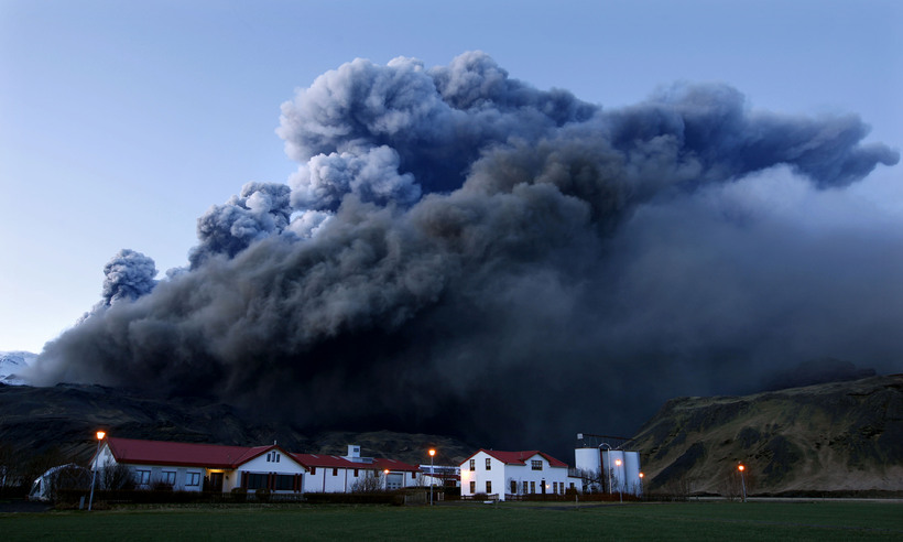
The latest eruption of Mount Sinabung in Sumatra killed seven people and injured two others. After lying dormant for 400 years, Sinabung has erupted several times since 2010 and is now Idonesia's most active volcano. Locals have maintained a close watch as the official alert status has fluctuated, and thousands had already been evacuated long before the eruption.

But many villagers remained in the area – and outsiders may well wonder why, given the volcano's recent history, people would not only live near the "red zone" (the restricted area within 3km of the summit) but also regularly venture into it. Surely local people know the risks of a "pyroclastic" cloud of superheated gas?

This is a question we've looked at in our research. The recent large eruption had an added personal component – we were leading a team that had been investigating why people continued to live near the red zone. Our researchers had been distributing questionnaires and conducting interviews in the village of Gamber and other villages bordering the red zone right up to the previous Tuesday, May 17.

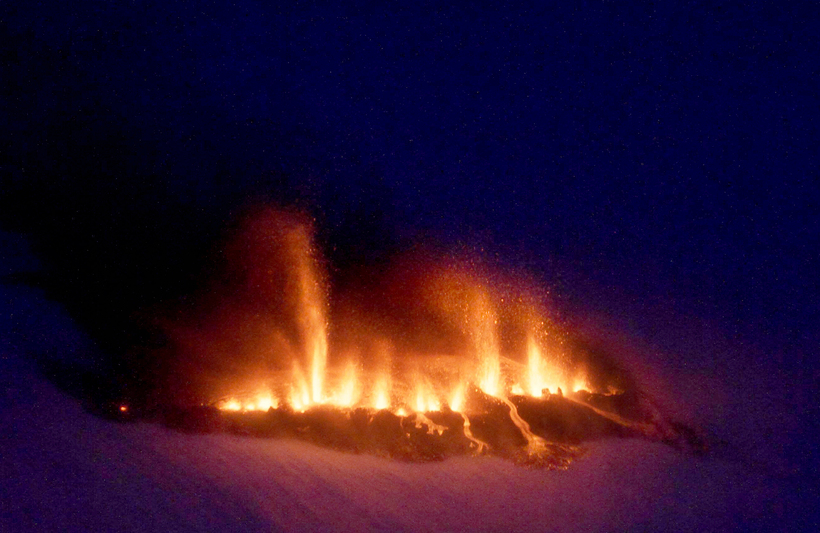
On several occasions, smaller eruptions sent huge plumes of superheated gas into the sky as well as down the slopes of the mountain towards inhabited villages. We were cautious – we monitored the situation closely and were ready to evacuate quickly if we needed to. We witnessed these eruptions with a mixture of excitement, awe and fear. This contrasted with the calm and – sometimes – complete indifference of locals.

Sinabung rumbles away in Jun 2015…but local farmers appear unconcerned. Dedhi Sahputra / EPA

The main eruption on May 22 sent a pyroclastic flow 4.5kms down the mountain, eventually reaching Gamber. Our experience in the field and knowledge of the devastating effects of other eruptions and natural hazards in Indonesia – such as the eruption of Mount Merapi in 2010 – meant that the latest tragic deaths were, sadly, not a surprise to us.

Villagers regularly go into the red zone to farm their land, for instance. But the villages themselves can face the additional risk of "lahars": potentially torrential flowing mixtures of water and rock fragments caused by heavy rainfall on the mountain. In the second week of our fieldwork, two children and one adult had been killed and a further child and adult were missing as a result of lahars not far from Gamber.

What next for communities around Sinabung?

While we are not yet ready to report on people's thoughts and actions in the week prior to the latest eruptions, there are some preliminary answers. Previous research tells us the key factors explaining why people live in these dangerous situations are attachment to place and the protection of their livelihoods as well as a capacity to adapt to natural hazards and the reduced perception of risk that involves.

A recent review by the International Federation of Red Cross and Red Crescent Societies highlighted the need for external agencies and organisations to set aside their own conceptions of risk and engage seriously with the "alternative rationalities" of local people. Considerations about whether to stay, relocate independently or be relocated by the government to other locations should reflect the priorities of villagers and their community identities.

In the case of Gamber and other villages like it, many are reluctant to leave land owned by generations of ancestors as long as they can also continue to make a living from it. And, while people may not seem to fear being injured or killed by an eruption, we heard that some are less likely to visit their land within the red zone when there are no volunteer observers from a local group watching the mountain.

Our research at Mount Sinabung also tells us that people who have been permanently relocated from the red zone to new villages far from the mountain appear to have a better quality of life and less risk of health problems from dense ash clouds, for instance. In contrast, many people who have been temporarily evacuated to shelters (known as "Posko") are in a desperate situation. They live in poor conditions with few offers of work and concerns about the quality of government-provided food. Some have now lived like this since 2010.

Villages outside the red zone have been designated safe by authorities but regular ash falls affect their health and reduce their ability to maintain farmland. For some, the ongoing eruptions will probably mean that their status as "refugees" will change soon.

View from a village next to the red zone. Gavin Sullivan, Author provided

In this context, what impact can our research hope to have? Cultural change might occur by, for example, educating young people about the risks and encouraging them to change the activities of their parents. And we hope to provide evidence of how living so close to a volcano affects the psychology, health and well-being of villagers. This will turn, allow related interventions to be developed.

Our findings may also demonstrate the importance of community-led initiatives, such as volunteer groups formed of local villagers, in facilitating communications with authorities about imminent threats and the need to evacuate. Living near the volcano is dangerous and complicated but support and solutions are possible.

https://theconversation.com/why-do-people-still-live-next-to-an-active-volcano-59947

***********************************************************

Phreatic danger still lurks in quiet Mayon Volcano — Phivolcs

by Philippine News Agency
May 27, 2016

By Catherine J. Teves

World-famous Mayon Volcano's quiet demeanor at present can be deceiving.

"Phreatic eruptions are still possible there," warned volcanologist Gerald Malipot from State-run Philippine Institute of Volcanology and Seismology (Phivolcs).

Mayon Volcano (MB file photo)

Mayon Volcano (MB file photo)

He noted such potentially deadly eruptions mostly occur without warning so it's best for people to avoid entering Mayon's six-kilometer radius permanent danger zone (PDZ) even if alert level for this volcano is zero at present.

"A deadly phreatic eruption occurred there on May 7, 2013 when Mayon was also at zero alert level," he recalled.

National Disaster Risk Reduction and Management Council (NDRRMC) reported such eruption lasted for about 73 seconds and killed five people who were within Mayon's PDZ at the time.

NDRRMC said the eruption also injured nine people.

According to experts, phreatic eruptions are steam-driven blasts that occur when water beneath the ground or on the surface transforms into steam after coming into contact with hot volcanic materials.

Phivolcs volcanologist Winchelle Sevilla earlier said there's still no means for giving advanced warnings about looming phreatic eruptions as research into this matter is going on.

"People must therefore avoid entering Mayon's PDZ," he said.

Rising some 2.46 kilometers above sea level, Mayon Volcano in Albay province has gained international fame for its near-perfect cone.

Phivolcs noted Mayon is among the Philippines' active volcanoes.

Malipot said Mayon was previously at alert level one as Phivolcs monitored low-level unrest there then.

Mayon's alert level has been zero since early February 2016 as Phivolcs' monitoring indicates minimal volcanic activity there, he said.

Zero alert level indicates Mayon is "quiet" and manifesting no imminent magmatic eruption, he added.

"Even at zero alert level, however, the risk for phreatic eruptions there remains," he clarified.

Malipot said Phivolcs monitors one to five volcanic earthquakes daily in Mayon despite this volcano's zero alert.

"Such occurrences are normal," he said.

Volcanic earthquakes help either create or increase crevices in Mayon, however, he noted

He said water can enter Mayon through such crevices, then come in contact with hot volcanic materials, transforming this liquid into steam.

Aside from phreatic eruptions, Phivolcs said lava flows and ashfall are among Mayon Volcano's hazards.

Precursors to Mayon eruptions include increased number of volcanic quakes and emissions there, ground tilt from magma intrusion and crater glow due to presence of magma at or near this volcano's crater, Phivolcs said.

Mayon's last magmatic eruption was in September 2014, the agency said.


http://www.mb.com.ph/phreatic-danger-still-lurks-in-quiet-mayon-volcano-phivolcs/#cpfv4UkqMAAgwXf4.99


--


__._,_.___

Posted by: Lin Kerns <linkerns@gmail.com>


__,_._,___
Newer Posts Older Posts Home