http://m.voanews.com/a/1816935.htmlScientist Say They Predicted Earthquake Location, Magnitude
December 24, 2013VOA News
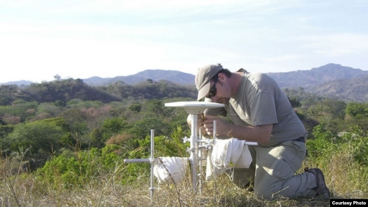
Andrew Newman, an associate professor in the School of Earth and Atmospheric Sciences at the Georgia Institute of Technology, performs a GPS survey in Costa Rica's Nicoya Peninsula in 2010. (Lujia Feng/Georgia Tech).
Scientists say they were able to forecast the size and location of an earthquake using GPS to study changes in the Earth's shape.
The Georgia Institute of Technology researchers say they predicted the magnitude 7.6 Nicoya earthquake that shook Costa Rica in 2012.
The Nicoya Peninsula in Costa Rica is one of the few places where land sits atop the portion of a subduction zone where the Earth's greatest earthquakes take place. That makes it a good spot for learning how large earthquakes rupture.
Subduction zones are locations where one tectonic plate is forced under another one and can often be the sites of devastating temblors. The magnitude 9.0 earthquake off the coast of Japan in 2011 was due to just such a subduction zone earthquake.
Because earthquakes greater than about magnitude 7.5 have occurred in this region roughly every 50 years, with the previous event striking in 1950, scientists have been preparing for this earthquake through a number of geophysical studies. The most recent study used GPS to map out the area along the fault storing energy for release in a large earthquake.
"This is the first place where we've been able to map out the likely extent of an earthquake rupture along the subduction megathrust beforehand," said Andrew Newman, an associate professor in the School of Earth and Atmospheric Sciences at the Georgia Institute of Technology.
Through a series of studies starting in the early 1990s using land-based tools, the researchers mapped regions where tectonic plates were completely locked along the subduction interface. Detailed geophysical observations of the region allowed the researchers to create an image of where the faults had locked.
The researchers published a study a few months before the Nicoya earthquake, describing the particular locked area with the clearest potential for the next large earthquake in the region. The team projected the total amount of energy that could have developed across that region and forecasted that if the locking remained similar since the last major earthquake in 1950, then there was likely enough energy for an earthquake on the order of magnitude 7.8 there.
"It occurred right in the area we determined to be locked and it had almost the size we expected," Newman said.
The researchers hope to apply what they've learned in Costa Rica to other environments. Virtually every damaging subduction zone earthquake occurs far offshore.
"Nicoya is the only place on Earth where we've actually been able to get a very accurate image of the locked patch because it occurs directly under land," Newman said. "If we really want to understand the seismic potential for most of the world, we have to go offshore."
Because of limits in technology and scientific understanding about processes controlling fault locking and release, scientists cannot say much about precisely when earthquakes will occur. However, earthquakes in Nicoya have occurred about every 50 years, so seismologists had been anticipating another one around 2000, give or take 20 years, Newman said.
Scientists have been able to reasonably map portions of these locked areas offshore using data on land, but the resolution is poor, particularly in the regions that are most responsible for generating tsunamis, Newman said. He hopes that his group's work in Nicoya will be a driver for geodetic studies on the seafloor to observe such Earth deformation. These seafloor geodetic studies are rare and expensive today.
"If we want to understand the potential for large earthquakes, then we really need to start doing more seafloor observations," Newman said. "It's a growing push in our community and this study highlights the type of results that one might be able to obtain for most other dangerous environments, including offshore the Pacific Northwest."
The study was published online Dec. 22, 2013, in the journal Nature Geoscience.
--
--
Check out http://groups.yahoo.com/group/californiadisasters/
Read my blog at http://eclecticarcania.blogspot.com/
My Facebook: http://www.facebook.com/derkimster
Linkedin profile: http://www.linkedin.com/pub/kim-noyes/9/3a1/2b8
Follow me on Twitter @DisasterKim
__._,_.___
Change settings via the Web (Yahoo! ID required)
Change settings via email: Switch delivery to Daily Digest | Switch to Fully Featured
Visit Your Group | Yahoo! Groups Terms of Use | Unsubscribe
__,_._,___
No comments:
Post a Comment