http://blogs.agu.org/landslideblog/2015/11/22/vasquez-canyon-1/22 November 2015
Vasquez Canyon: a new landslide in Santa Clarita, California
Posted by dr-dave
Vasquez Canyon landslide
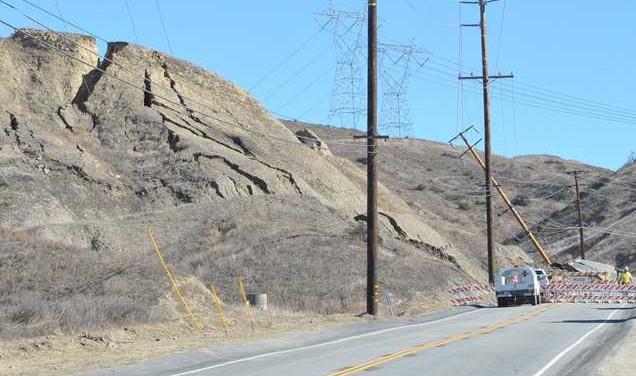
A significant landslide has developed in the last few days in Vasquez Canyon, in Santa Clarita in California. The landslide, which appears to be progressive and has no obvious recent trigger, has caused extensive buckling of the road, which has been closed over a three kilometre stretch. This image, from the Santa Clarita Valley Signal, provides quite a good general view of the situation beyond the road:
The landslide, from the Santa Clarita Valley Signal
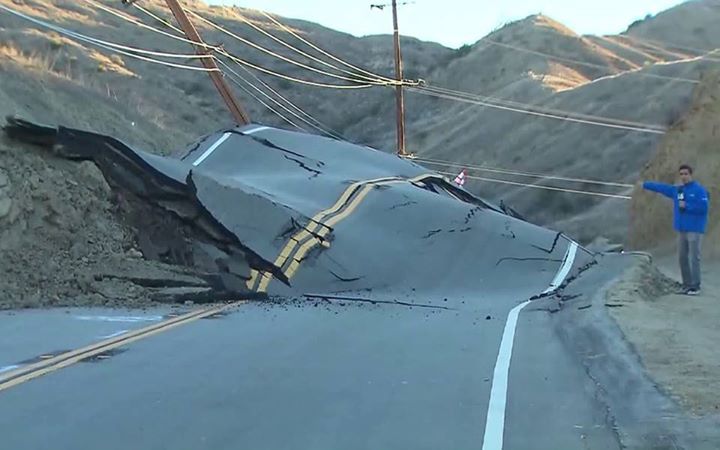
The landslide has caused impressive damage to the highway:
Vasquez Canyon road from KTLA5
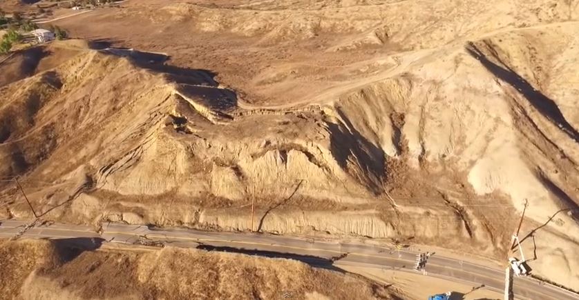
interestingly, the media are suggesting that this buckling has occurred because the road is moving upwards. Whilst this might sound a little odd, this excellent drone footage suggests that this might the case:
This is a still from the drone footage of the landslides, showing the damage to the highway:
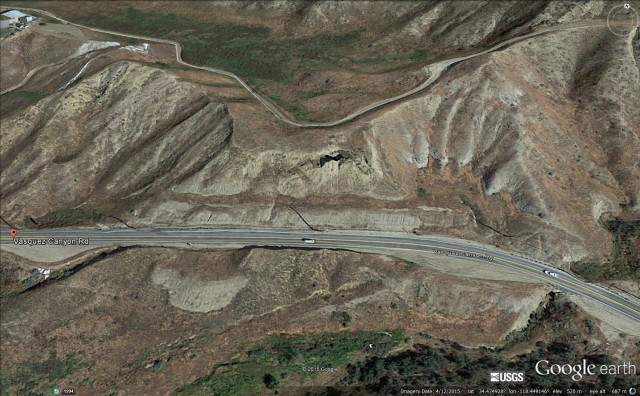
This is Google Earth imagery of this section of the road, dated April 2015 – i.e. seven months ago:
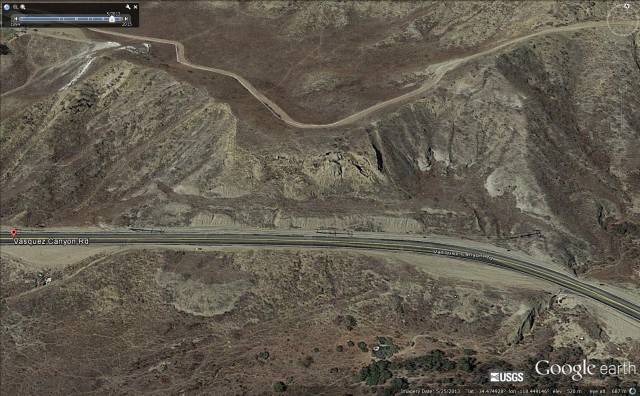
There are clearly some signs of instability in this image, and note the other landslides in the image. The section of road that has failed is in a box cut, so it would appear that unloading of the slope may be a key factor in the landslide. And interestingly, this imagery from two years ago (May 2013) suggests significant movement at that time as well:
And finally, this is Google Street View imagery of the road, taken in 2011:
The extensive deformation in the road was clear even then – indeed the road shows longitudinal cracks along this entire section. Thus, although this landslide looks very sudden, it has been developing over a prolonged period.
--
__._,_.___
Posted by: Kate Hutton <katehutton@gmail.com>
Be sure to check out our Links Section at http://groups.yahoo.com/group/californiadisasters/links
Please join our Discussion Group at http://groups.yahoo.com/group/californiadisasters_discussion/ for topical but extended discussions started here or for less topical but nonetheless relevant messages.


No comments:
Post a Comment