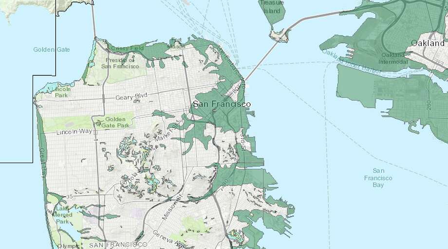
Updated quake map tells you if you live in a liquefaction zone
It also highlights areas at risk of landslides
- Antioch North quadrangle
- Antioch South quadrangle
- Honker Bay quadrangle
- Montara Mountain quadrangle
- Woodside quadrangle.
The Contra Costa communities covered include all or parts of Antioch, Concord, Brentwood, Oakley, Pittsburg and Bay Point. In San Mateo, communities impacted include all or parts of Woodside, San Carlos, Belmont, Burlingame, Half Moon Bay, Hillsborough, Millbrae, Redwood City, San Bruno, San Carlos, Portola Valley and Pacifica.
Some Bay Area locations – for example, northern Pacifica and Daly City — have not been evaluated for liquefaction or landslide.
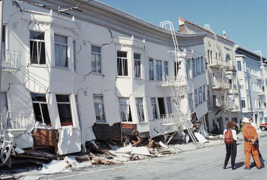
Damage to the Marina District, San Francisco, following the 1989 Loma Prieta earthquake.
SEE ALSO: Living in a liquefaction zone — the Bay Area's riskiest neighborhoods
Living in an area with high risk of liquefaction does not necessarily mean your house will be damaged should a major quake strike. Newer buildings and retro-fitted structures are better equipped to weather temblors, especially those in modern, engineered artificial fill zones.
You can read more about about the Bay Area's liquefaction zones here.
--

Groups.io Links:
You receive all messages sent to this group.
View/Reply Online (#31925) | Reply To Group | Reply To Sender | Mute This Topic | New Topic
Your Subscription | Contact Group Owner | Unsubscribe [volcanomadness1@gmail.com]
No comments:
Post a Comment