Dramatic images show the extent of California's drought over the years
By Jonathan Lloyd| KNBC-TV Los Angeles
Updated at 11:05 AM PDT on Thursday, Apr 2, 2015The images below illustrate the severity of California's drought with past and recent images from around the state, now in its fourth consecutive dry year.
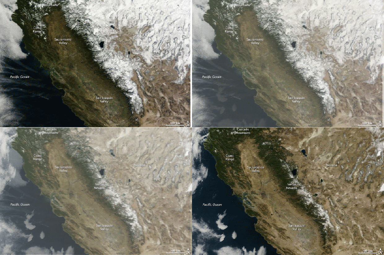
Some of the images are from north-central California's Lake Oroville, where receeding water levels over the past four years have revealed large swaths of lakebed. Other images from NASA show the dramatic snowpack reduction in the Sierra Nevada range, where springtime runoff provides water for an estimated 25 million Californians.
App Users: Scroll to bottom of article to access images on mobile site
Lake Oroville: July 20, 2011 - Aug. 19. 2014
The image below shows Lake Oroville near the Bidwell Marina in north-central California. The first image shows full water under the Green Bridge in July 2011. The second image from August 2014 shows a dramatic change as the lake reached 32 percent of its total 3,537,577 acre feet.
Folsom Dam: July 20, 2011 - Aug. 19, 2014
In the image below, full water levels are seen at Folsom Dam at Folsom Lake on July 20, 2011 in El Folsom, California. Significant lower water levels are visible behind the dam on August 19, 2014 in the next image, which shows the lake at 40 percent of its total capacity of 977,000 acre feet.
Bidwell Marina, Oroville: July 20, 2011 - Aug. 19, 2014
The images below show Bidwell Marina at Lake Oroville in north-central California in July 2011 and August 2014. Lake and reservoir water levels across the state are at historic lows.
Lake Oroville, Enterprise Bridge: July 20, 2011 - Aug. 19, 2014
The before-and-after images below provide an aerial view of Enterprise Bridge over Lake Oroville. The first image show full water levels in July 2011, the second image shows a significant water-level drop in August 2014.
Sierra Nevada Range: January 2013 - January 2014
These NASA images show the difference in Sierra Nevada range snowpack between January 2013 and January 2014. Springtime runoff from the snowpack provides water for millions of Californians.
Mount Shasta: Nov. 1, 2013 - Jan. 4, 2014
NASA's Operational Land Imager on the Landsat 8 satellite captured these images of California's Mount Shasta. The first shows a snow-covered peak in January 2014, the second shows a naked landscape in November 2014 after a dry season.
Go here to see both images from each location:http://www.nbclosangeles.com/news/local/California-Drought-Images-Now-Then-Before-After-Comparison-298456561.html
--
Read my blog at http://eclecticarcania.blogspot.com/
My Facebook: http://www.facebook.com/derkimster
Linkedin profile: http://www.linkedin.com/pub/kim-noyes/9/3a1/2b8
Follow me on Twitter @CalDisasters
__._,_.___


No comments:
Post a Comment