The Blackhawk Landslide
The Blackhawk landslide
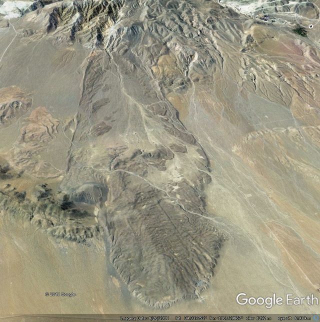
The Blackhawk landslide is without doubt one of the most impressive rock avalanches on Earth. It is located at 34.393, -116.773 in the Lucerne Valley on the escarpment that divides the San Bernardino Mountains to the south from the Mojave Desert to the north, in California. This is a Google Earth image of the landslide source and deposit:-

A Google Earth image of the Blackhawk landslide in the Lucerne Valley of California.
.
As the image shows, this is a landslide on a very grand scale. With an estimated volume of about 300 million cubic metres, the landslide extends over a distance of about 9 km from the crown to the toe, with a deposit that is up to 2 km wide and up to 30 m thick. The fall height is estimated to be about 1,200 m in total, making this a highly mobile landslide.
The event is not recent. Dating of the deposit suggests that it may have occurred about 18,000 years ago, although there is huge uncertainty in that date. However, in the dry desert environment of inland California the landslide is exceptionally well-preserved, and of course the landslide mass contrasts with the valley floor, rendering the mass highly visible.
This is a landslide that is surprisingly poorly investigated. There is a very nice PhD thesis from 1959 by Ronald Shreeve that is online, which describes the geology and mechanics of the landslide. This was in the days in which a PhD thesis could be just 84 pages long (there are lessons to learn from that!). Shreeve describes the geology, and tries to explain the exceptional mobility of the landslide, hypothesizing that it may have moved on a lubricating basal air layer. There is also a nice blog article about it on the excellent Looking for Detachment blog. Finally, there is a book chapter from 1978 about the landslide by Brann Johnson, but even the University of Sheffield subscription to Science Direct does not provide access to that one.
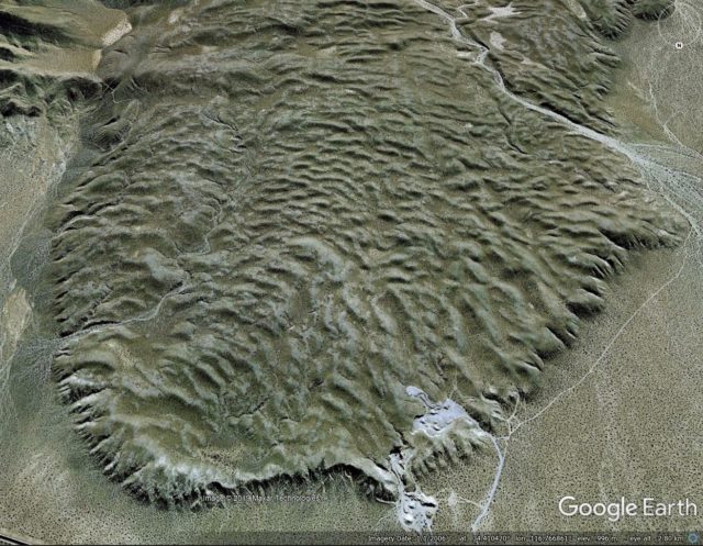
This is landslide that would really benefit from a revisit using up to date techniques. There is exquisite hummocky morphology in the landslide deposit, captured well in the this 2006 Google Earth image:-

Google Earth image of the Blackhawk landslide in California
.
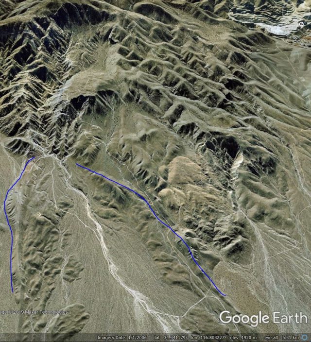
And to me, the now dissected landslide source area suggests that this might have been quite a complex event too. This is a Google Earth image of the landslide scar area; I have annotated the approximate boundaries of the upper part of the deposit:-

Google Earth image of the source area of the Blackhawk landslide.
.
The implication appears to be a highly unusual morphology of the landslide scar. It is not clear to me how the mechanics of this part of the landslide motion would have operated – is there a large volume of stalled material still within the scar area?
Acknowledgement and footnote
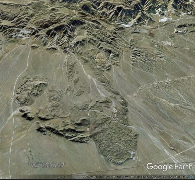
Many thanks to my friend funkenbeachin for pointing out this landslide, and for the discussions about it. He has hypothesised that there may be other events in this area as well – take a look at the image below. It is not hard to believe that there is more than one landslide deposit on the valley floor:-

Wide angle Google Earth view of the valley floor around the Blackhawk landslide
--
Groups.io Links:
You receive all messages sent to this group.
View/Reply Online (#32835) | Reply To Group | Reply To Sender | Mute This Topic | New Topic
Your Subscription | Contact Group Owner | Unsubscribe [volcanomadness1@gmail.com]

No comments:
Post a Comment