As the symptoms of climate change reveal themselves, the need to prepare for sea level rise grows more stark each year
There's a lot to like about the Bay Area's efforts to prepare for sea level rise: the collaborative efforts, the detailed studies and, laudably, the voters who are willing to tax themselves with an eye to future needs.
But if the long-term threat is as grim as scientific projections indicate, local experts say the region needs to respond with increased urgency — an urgency that is at odds with the Bay Area's often cumbersome decision-making processes.
"Are we moving fast enough? I don't believe we are," said Dave Pine, a San Mateo County supervisor. "It's hard for policy makers — or humans in general — to internalize the magnitude of the problem and plan now for the future."
Pine is no wild-eyed advocate: The second-term supervisor chairs the Bay Restoration Authority, which disperses the $25 million generated each year by a regional parcel tax that voters approved in 2016.
The rationale for Measure AA is that the region needed a dedicated funding source to move wetlands restoration efforts forward — not just for aesthetic reasons but to provide natural buffers that can help soften and absorb the impact of rising sea levels within the bay. The sun is rising over at the Sears Point Restoration Wetlands site on the edge of San Pablo Bay in Novato. | Michael Macor / The Chronicle
But if the long-term threat is as grim as scientific projections indicate, local experts say the region needs to respond with increased urgency — an urgency that is at odds with the Bay Area's often cumbersome decision-making processes.
"Are we moving fast enough? I don't believe we are," said Dave Pine, a San Mateo County supervisor. "It's hard for policy makers — or humans in general — to internalize the magnitude of the problem and plan now for the future."
Pine is no wild-eyed advocate: The second-term supervisor chairs the Bay Restoration Authority, which disperses the $25 million generated each year by a regional parcel tax that voters approved in 2016.
The rationale for Measure AA is that the region needed a dedicated funding source to move wetlands restoration efforts forward — not just for aesthetic reasons but to provide natural buffers that can help soften and absorb the impact of rising sea levels within the bay.
The sun is rising over at the Sears Point Restoration Wetlands site on the edge of San Pablo Bay in Novato. | Michael Macor / The ChronicleThere's no overall price tag for adapting the bay's 400 miles of shoreline, which in time could approach $100 billion. But Measure AA is a step in the right direction of adding predictable streams of funding from here on out.
The most recent set of scientific estimates for the bay was released last year by the California Ocean Protection Council. Its "probabilistic projections" for 2050 are relatively modest, with the "likely" level of increase in the 1-foot range. By 2100, though, the "likely" projection puts sea level rise within the bay at around 40 inches, while the upper-level forecast is more than 80 inches — nearly 7 feet.
The range of the projections is affected by whether carbon emission levels fall significantly or if they continue at current levels. The state also included an "extreme scenario" — not a formal scientific projection — that factored in ice loss from Antarctica and has the tide levels climbing 10 feet.
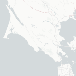
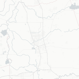
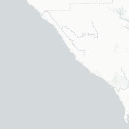
Rising seas, altered shoreline
Sea level rise is a product of climate change that could severely change the shoreline of San Francisco Bay. But predicting how high the water might rise, and when, depends on several factors that yield a wide range of possibilities. Click on an arrow to change the criteria and see the different outcomes on the map.
The most recent set of scientific estimates for the bay was released last year by the California Ocean Protection Council. Its "probabilistic projections" for 2050 are relatively modest, with the "likely" level of increase in the 1-foot range. By 2100, though, the "likely" projection puts sea level rise within the bay at around 40 inches, while the upper-level forecast is more than 80 inches — nearly 7 feet.
The range of the projections is affected by whether carbon emission levels fall significantly or if they continue at current levels. The state also included an "extreme scenario" — not a formal scientific projection — that factored in ice loss from Antarctica and has the tide levels climbing 10 feet.
Rising seas, altered shoreline
Sea level rise is a product of climate change that could severely change the shoreline of San Francisco Bay. But predicting how high the water might rise, and when, depends on several factors that yield a wide range of possibilities. Click on an arrow to change the criteria and see the different outcomes on the map.
Low-lying areas
Water depth ⟶
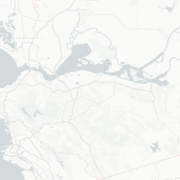


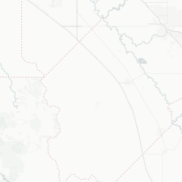


* Emissions decline around 70% between 2015 and 2050, to zero by 2080, and below zero from then on.
The water level on this map is the prediction rounded to the nearest whole number, and represents the daily high tide.
Sources: NOAA, California Natural Resources Agency and California Ocean Protection Council
The water level on this map is the prediction rounded to the nearest whole number, and represents the daily high tide.
Sources: NOAA, California Natural Resources Agency and California Ocean Protection Council
Whatever the precise numbers or timing, environmental advocates see a common thread.
"All the changes are in the same direction, and they're all happening faster than was estimated a few years ago," said David Lewis, executive director of Save the Bay. "That's what's relevant."
One proactive step is to create marshes and vegetated beaches. Such features can create naturalistic buffers against rising tides and climate change-related storms that otherwise could threaten transportation routes as well as low-lying communities such as East Palo Alto, Alameda and the working-class Canal District of San Rafael.
The catch is, the process of planning and financing such projects — and gathering permits — can take a decade or more.
There has been progress, especially in the former salt ponds of the South Bay. But as of now, 56,000 acres of marshland exist. Another 18,000 acres of restoration projects are in the planning stage.
That leaves 26,000 acres to go.
"The point of the baylands update was to stress that we need to dramatically accelerate the rate and quantity of wetlands restoration," said Warner Chabot, executive director of the Estuary Institute. "Instead, we're at a pace to solve maybe a quarter to a third of the problem."
Bay Area decision-makers aren't downplaying or denying climate change, as is the case with President Trump and his advisers. But this is a region that for the past half-century has created regulatory processes intended to be as detailed and wide-ranging as possible. Nothing happens quickly, whether the issue is transportation or housing.
Or sea level rise.
Case in point: the slow pace of efforts by the Bay Conservation and Development Commission to reduce the amount of red tape around adding marshes.
The agency was founded in 1965, the result of a crusade by Bay Area residents to stop the cavalier filling of shallow bay waters to make room for everything from office parks to garbage dumps. Its centerpiece is the Bay Plan, which includes prohibitions on anything except "the minimum amount of fill necessary."
But creating or restoring marshlands often meets the definition of fill, such as when wide bands of sediment are laid down to form horizontal levees where cord grass and other vegetation can take root. Because of this, the agency has made it a priority to revise the bay plan with regard to fill since at least 2016, when commission chair Zack Wasserman told his fellow commissioners: "We need to speed up our response to climate change now."
"Looking back, amending the plan (with regards to fill) is something we should have been able to do more quickly," said Pine, who has been on the commission since 2012. "We're going to have to do a lot better in the future."
One sign of progress, though it sounds arcane, is a collaborative effort among six regulatory agencies that kicked off in August.
The title is the San Francisco Bay Restoration Regulatory Integration Team. The aim is to speed the pace of permitting habitat projects that by law are required to wend their way through a succession of agencies, each with its own set of priorities.
Wasserman's agency is part of the team. Other members include the U.S. Army Corps of Engineers, the California Department of Fish and Wildlife, and the Regional Water Quality Control Board. Each has a full-time employee assigned to shepherd new projects through the system in a more streamlined manner.
"We started by looking at the 'sand in the gears' — what was slowing things down," said Amy Hutzel, deputy executive officer of the state Coastal Conservancy, an agency that's active in restoration efforts. "There are going to be tensions that come up, but the agencies all want to do this."
Another fresh effort at collaboration is San Mateo County's Flood and Sea Level Rise Resiliency Agency, created this year.
Its purpose is implied by the title: to consolidate old-school flood control with the emerging climate realities. The idea is a single agency that coordinates work among cities and brings a countywide focus to dealing with state and federal regulatory bodies.
"We saw the need for an agency that can build staff expertise and work across jurisdictional lines," Pine said, describing the origins of the resiliency agency. The more focused approach, he also suggested, "should help us to pursue any buckets of money that are available."
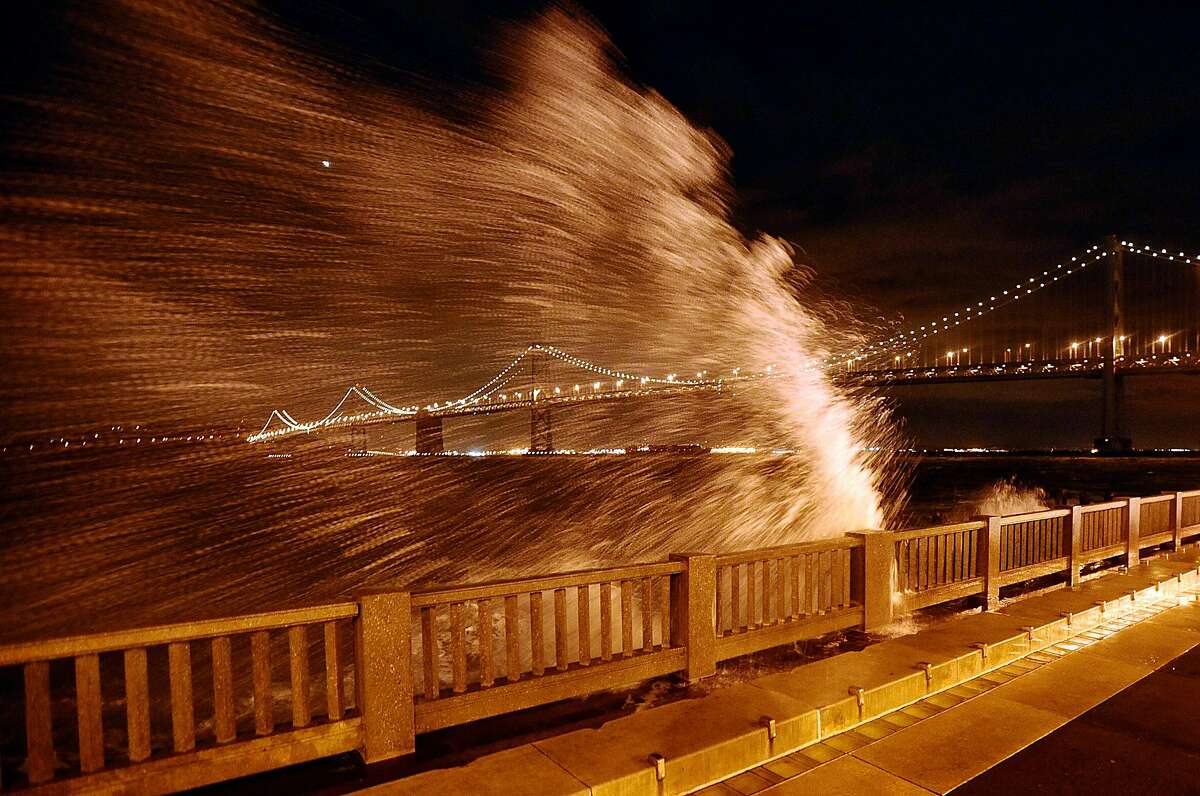 Waves break over the Embarcadero seawall near the foot of Howard Street. | Noah Berger / Special To The Chronicle 2008
There's a different challenge in San Francisco — where city leaders are faced with upgrading the century-old seawall beneath the Embarcadero.
The driving force is seismic concerns: Major damage to the crude barrier of rocks and concrete could dislodge utilities, destroy historic buildings above it and send water streaming inland. But a stronger seawall must also be higher, given the likelihood of sea level rise.
The Port of San Francisco's planning efforts were endorsed last year by city voters, who approved a $425 million bond to fund the first phase of an effort that eventually could cost upward of $5 billion. The port also is working with the Army Corps on a major study of potential flood risks along the port's 7.5-mile-long stretch of property.
In the meantime, though, the port is allowing development of sites such as Pier 70, where slopes are being raised as much as 5 feet by developer Brookfield Properties to climb above the sea level rise projections that were in place when the project was approved in 2017.
"We believe the current waterfront can be adapted for a prolonged period of time," said Elaine Forbes, the port's executive director. "To think we're not going to use our shoreline because we're waiting for future events would close off tremendous opportunities in the meantime" with regards to public access and, at Pier 70, as many as 2,100 housing units.
Veterans of adaptation efforts in the Bay Area are hoping that the signs of progress signal the beginning of a more fundamental shift.
"I really do think we're at the precipice of a lot of things starting to happen," said Laura Tam, a policy director for the urban planning think tank SPUR. "More local governments are looking for ways to take action."
--

_._,_._,_
Groups.io Links:
You receive all messages sent to this group.
View/Reply Online (#32346) | Reply To Group | Reply To Sender | Mute This Topic | New Topic
Your Subscription | Contact Group Owner | Unsubscribe [volcanomadness1@gmail.com]
_._,_._,_
No comments:
Post a Comment